
~ Highland Park IL topo map, 1:24000 scale, 7.5 X 7.5 Minute, Historical, 1993, updated 1993
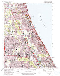
Highland Park, Illinois, USGS topographic map dated 1993.
Includes geographic coordinates (latitude and longitude). This topographic map is suitable for hiking, camping, and exploring, or framing it as a wall map.
Printed on-demand using high resolution imagery, on heavy weight and acid free paper, or alternatively on a variety of synthetic materials.
Topos available on paper, Waterproof, Poly, or Tyvek. Usually shipping rolled, unless combined with other folded maps in one order.
- Product Number: USGS-5676820
- Free digital map download (high-resolution, GeoPDF): Highland Park, Illinois (file size: 19 MB)
- Map Size: please refer to the dimensions of the GeoPDF map above
- Weight (paper map): ca. 55 grams
- Map Type: POD USGS Topographic Map
- Map Series: HTMC
- Map Verison: Historical
- Cell ID: 70377
- Scan ID: 307811
- Imprint Year: 1993
- Woodland Tint: Yes
- Aerial Photo Year: 1988
- Edit Year: 1993
- Field Check Year: 1992
- Datum: NAD27
- Map Projection: Universal Transverse Mercator
- Map published by United States Geological Survey
- Keywords: Overedge
- Map Language: English
- Scanner Resolution: 600 dpi
- Map Cell Name: Highland Park
- Grid size: 7.5 X 7.5 Minute
- Date on map: 1993
- Map Scale: 1:24000
- Geographical region: Illinois, United States
Neighboring Maps:
All neighboring USGS topo maps are available for sale online at a variety of scales.
Spatial coverage:
Topo map Highland Park, Illinois, covers the geographical area associated the following places:
- Glenbrook Countryside - Northbrook Manor - Cotswald Subdivision - Lone Tree Subdivision - Dundee Road Acres - Meyer's Subdivision - Blodgett - Fair Meadows - Saint Stephens Green - Northbrook Mews - Northbrook Oaks - Red Haw Ridge - Wilshire Terrace - Braeside - Briergate - Marlen Subdivision - Bachs Addition - Briergate Station - Northwood Edens - Dunsten Green - Manus North Shore Estates - Bradless Subdivision - Kingsport Court - Old Colony Court - Northbrook Heights - Sportmans Cove - Clarke's Subdivision - Lane Park - Kinchester Lane Subdivision - Northbrook Glen - Coral Manor - Ravinia - Weller's Subdivision - Skokie Manor - Olson's Subdivision - Lee Acres - Buttonwood - Sycamore Lane - Highmoor - Deerfield - Glencoe - Northbrook - Highwood - Shermer Square - Skokie Highlands - Dean-Horsch Subdivision - Northbrook Highlands - Chapel Hill Estates - Lee Woods - Wildebrook On The Green - Star Subdivision - Mission Hills Estates - Charring Cross - Carlye Subdivision - Little Orchard Subdivision - Deerpath - Highland Park - Bannockburn - Colonial Village - Ridgecroft - Water Edge Subdivision - Charlemagne East - Northfield Acres - Sunridge - Huntington - Heart O' Northbrook - Ville Du Parc - White Plains - Linden Ridge - Oury Point - Northbrook East - Markus Subdivision - Garden Court - Innisfail - Woodlands - Fair Acres - Del Mar Woods - Greenbriar Highlands - Northbrook Colonial Estates - Grace Manor - West Lake Forest - Brookside Estates - Timber Lane - Timber Ridge - Woodridge - Shermer Ridge - Thorn Hill - Evergreen Subdivision - Shermerville - Everett - Ancient Tree - Rugen Subdivision - Williamsburg Square - Briarwood Glen - Estates of Charlemagne - Northbrook Estates - Tiber Hill Estates - Pheasant Creek - Northbrook Villa - Kennedy
- Map Area ID: AREA42.2542.125-87.875-87.75
- Northwest corner Lat/Long code: USGSNW42.25-87.875
- Northeast corner Lat/Long code: USGSNE42.25-87.75
- Southwest corner Lat/Long code: USGSSW42.125-87.875
- Southeast corner Lat/Long code: USGSSE42.125-87.75
- Northern map edge Latitude: 42.25
- Southern map edge Latitude: 42.125
- Western map edge Longitude: -87.875
- Eastern map edge Longitude: -87.75


