
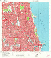
~ Chicago Loop IL topo map, 1:24000 scale, 7.5 X 7.5 Minute, Historical, 1963, updated 1973
Chicago Loop, Illinois, USGS topographic map dated 1963.
Includes geographic coordinates (latitude and longitude). This topographic map is suitable for hiking, camping, and exploring, or framing it as a wall map.
Printed on-demand using high resolution imagery, on heavy weight and acid free paper, or alternatively on a variety of synthetic materials.
Topos available on paper, Waterproof, Poly, or Tyvek. Usually shipping rolled, unless combined with other folded maps in one order.
- Product Number: USGS-5676810
- Free digital map download (high-resolution, GeoPDF): Chicago Loop, Illinois (file size: 26 MB)
- Map Size: please refer to the dimensions of the GeoPDF map above
- Weight (paper map): ca. 55 grams
- Map Type: POD USGS Topographic Map
- Map Series: HTMC
- Map Verison: Historical
- Cell ID: 8470
- Scan ID: 307269
- Imprint Year: 1973
- Woodland Tint: Yes
- Photo Revision Year: 1972
- Aerial Photo Year: 1972
- Edit Year: 1963
- Survey Year: 1926
- Datum: NAD27
- Map Projection: Polyconic
- Map published by United States Geological Survey
- Map Language: English
- Scanner Resolution: 600 dpi
- Map Cell Name: Chicago Loop
- Grid size: 7.5 X 7.5 Minute
- Date on map: 1963
- Map Scale: 1:24000
- Geographical region: Illinois, United States
Neighboring Maps:
All neighboring USGS topo maps are available for sale online at a variety of scales.
Spatial coverage:
Topo map Chicago Loop, Illinois, covers the geographical area associated the following places:
- Lombard Tree - Cuyler - Simons - Grayland - West Ravenwood - West Ridge - West Garfield Park - Avondale - Carl Sandburg Village - Little Sicily - Central Park - Frances Cabrini Homes - Cedar Lawn - Uptown - Ravenswood Place - Gold Coast - William Green Homes - Humboldt - Ravenswood - Garfields - East Garfield Park - Nearwest Side - Bowmanville - Towertown - Pennock - Marshall Field Garden Apartments - Lincoln Park - West Edgewater - Hamlin Park - Carpenters Addition - North Center - Mid-North District - Summerdale - Lincoln Square (historical) - Irving Park - North Edgewater - Wolcotts and Bushnells Additions - Fifty Acres - West Town - Sunnyside - Humboldt Park - Swede Town - Mayfair - Granville Gardens - Near North Side - Edgewater - Wolcott Gardens - South Edgewater - California Park - Maplewood - North Park - Little Hell - Cabrini Addition - Montrose - Six Corners - Winchester-Hood Garden Homes - Pacific Junction - Killgubbin - Moreland - Swedentown - Belgravia Terrace - Ravenswood Manor - Hermosa - Albany Park - Logan Square - Pine Grove - Buena Park - Duncans Addition - Ravenswood Gardens - Olsen-Hansen Row Houses - Canal Trustees - Maplewood Courts - Fort Dearborn Addition - Sauganash - Bricktown - Winnemac - Kelvyn Grove - McCormickville
- Map Area ID: AREA4241.875-87.75-87.625
- Northwest corner Lat/Long code: USGSNW42-87.75
- Northeast corner Lat/Long code: USGSNE42-87.625
- Southwest corner Lat/Long code: USGSSW41.875-87.75
- Southeast corner Lat/Long code: USGSSE41.875-87.625
- Northern map edge Latitude: 42
- Southern map edge Latitude: 41.875
- Western map edge Longitude: -87.75
- Eastern map edge Longitude: -87.625


