
~ Timber Butte ID topo map, 1:24000 scale, 7.5 X 7.5 Minute, Historical, 1977, updated 1977
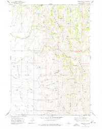
Timber Butte, Idaho, USGS topographic map dated 1977.
Includes geographic coordinates (latitude and longitude). This topographic map is suitable for hiking, camping, and exploring, or framing it as a wall map.
Printed on-demand using high resolution imagery, on heavy weight and acid free paper, or alternatively on a variety of synthetic materials.
Topos available on paper, Waterproof, Poly, or Tyvek. Usually shipping rolled, unless combined with other folded maps in one order.
- Product Number: USGS-5676780
- Free digital map download (high-resolution, GeoPDF): Timber Butte, Idaho (file size: 11 MB)
- Map Size: please refer to the dimensions of the GeoPDF map above
- Weight (paper map): ca. 55 grams
- Map Type: POD USGS Topographic Map
- Map Series: HTMC
- Map Verison: Historical
- Cell ID: 45137
- Scan ID: 238510
- Imprint Year: 1977
- Woodland Tint: Yes
- Aerial Photo Year: 1972
- Field Check Year: 1974
- Datum: NAD27
- Map Projection: Transverse Mercator
- Map published by United States Geological Survey
- Keywords: Overedge
- Map Language: English
- Scanner Resolution: 600 dpi
- Map Cell Name: Timber Butte
- Grid size: 7.5 X 7.5 Minute
- Date on map: 1977
- Map Scale: 1:24000
- Geographical region: Idaho, United States
Neighboring Maps:
All neighboring USGS topo maps are available for sale online at a variety of scales.
Spatial coverage:
Topo map Timber Butte, Idaho, covers the geographical area associated the following places:
- Quartz Gulch - Horse Spring - Sheep Spring Creek - Middle Fork Hannahs Fork - Tunnel Hill Spring - Meadow Spring - South Hannahs Fork - Willow Spring - U C Spring - Little Goose Creek - Box Canyon Spring - Lime Spring - Timber Butte - Jones Creek - Rattlesnake Spring - Dry Gulch - Little Piney Creek - Elison Hole Creek - Willis Spring - Beer Mug Spring - Cherry Spring - Indian Camp Spring Creek - South Fork Little Piney Creek - Meadow Spring Creek - North Fork Hannahs Fork - Indian Camp Spring - Winecup Creek - Pleasant Spring - Ruby Gulch - Van Eaton Spring - Willow Spring Creek - Palmer Creek - Rattlesnake Creek - Grouse Creek Spring - Pot Hole Basin - Beatty Spring - Japanese Spring - Timber Spring - Diamond Flat Spring - Basque Spring - Buck Creek - Deadline Ridge - Port Spring - Winecup Spring - Beatty Creek - Muddy Spring - Pot Hole Spring Number 2 - Sheep Spring
- Map Area ID: AREA42.12542-114.375-114.25
- Northwest corner Lat/Long code: USGSNW42.125-114.375
- Northeast corner Lat/Long code: USGSNE42.125-114.25
- Southwest corner Lat/Long code: USGSSW42-114.375
- Southeast corner Lat/Long code: USGSSE42-114.25
- Northern map edge Latitude: 42.125
- Southern map edge Latitude: 42
- Western map edge Longitude: -114.375
- Eastern map edge Longitude: -114.25


