
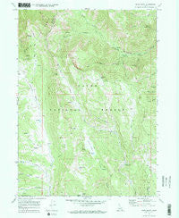
~ Egan Basin ID topo map, 1:24000 scale, 7.5 X 7.5 Minute, Historical, 1969, updated 1973
Egan Basin, Idaho, USGS topographic map dated 1969.
Includes geographic coordinates (latitude and longitude). This topographic map is suitable for hiking, camping, and exploring, or framing it as a wall map.
Printed on-demand using high resolution imagery, on heavy weight and acid free paper, or alternatively on a variety of synthetic materials.
Topos available on paper, Waterproof, Poly, or Tyvek. Usually shipping rolled, unless combined with other folded maps in one order.
- Product Number: USGS-5676712
- Free digital map download (high-resolution, GeoPDF): Egan Basin, Idaho (file size: 14 MB)
- Map Size: please refer to the dimensions of the GeoPDF map above
- Weight (paper map): ca. 55 grams
- Map Type: POD USGS Topographic Map
- Map Series: HTMC
- Map Verison: Historical
- Cell ID: 13746
- Scan ID: 236017
- Imprint Year: 1973
- Woodland Tint: Yes
- Visual Version Number: 2
- Aerial Photo Year: 1968
- Field Check Year: 1969
- Datum: NAD27
- Map Projection: Polyconic
- Map published by United States Geological Survey
- Keywords: Overedge
- Map Language: English
- Scanner Resolution: 600 dpi
- Map Cell Name: Egan Basin
- Grid size: 7.5 X 7.5 Minute
- Date on map: 1969
- Map Scale: 1:24000
- Geographical region: Idaho, United States
Neighboring Maps:
All neighboring USGS topo maps are available for sale online at a variety of scales.
Spatial coverage:
Topo map Egan Basin, Idaho, covers the geographical area associated the following places:
- Pat Hollow - Corral Hollow - Danish Pass - Horse Lake - Snowslide Canyon - Franklin Basin - Cloverleaf Campground - Red Pine Spring - Cub Basin - South Fork Saint Charles Creek - White Canyon - Big Creek Lake - Hodge Nibley Creek - Middle Fork Saint Charles Creek - Egan Basin - Boss Canyon - Porcupine Campground - Porcupine Hollow - Cub Basin Spring - Gibson Basin - Hidden Lake - Blue Lake - Beaver Creek Campground - Wiggler Lake - Red Sinks - North Fork Saint Charles Creek
- Map Area ID: AREA42.12542-111.625-111.5
- Northwest corner Lat/Long code: USGSNW42.125-111.625
- Northeast corner Lat/Long code: USGSNE42.125-111.5
- Southwest corner Lat/Long code: USGSSW42-111.625
- Southeast corner Lat/Long code: USGSSE42-111.5
- Northern map edge Latitude: 42.125
- Southern map edge Latitude: 42
- Western map edge Longitude: -111.625
- Eastern map edge Longitude: -111.5


