
~ Shinarump NW AZ topo map, 1:24000 scale, 7.5 X 7.5 Minute, Historical, 1954, updated 1956
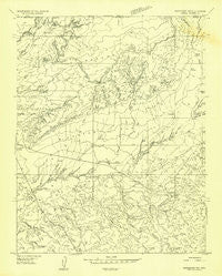
Shinarump NW, Arizona, USGS topographic map dated 1954.
Includes geographic coordinates (latitude and longitude). This topographic map is suitable for hiking, camping, and exploring, or framing it as a wall map.
Printed on-demand using high resolution imagery, on heavy weight and acid free paper, or alternatively on a variety of synthetic materials.
Topos available on paper, Waterproof, Poly, or Tyvek. Usually shipping rolled, unless combined with other folded maps in one order.
- Product Number: USGS-5676506
- Free digital map download (high-resolution, GeoPDF): Shinarump NW, Arizona (file size: 9 MB)
- Map Size: please refer to the dimensions of the GeoPDF map above
- Weight (paper map): ca. 55 grams
- Map Type: POD USGS Topographic Map
- Map Series: HTMC
- Map Verison: Historical
- Cell ID: 41094
- Scan ID: 313343
- Imprint Year: 1956
- Aerial Photo Year: 1953
- Datum: Unstated
- Map Projection: Unstated
- Preliminary map: Yes
- Map published by United States Geological Survey
- Keywords: Overedge; Nonstandard Press Run
- Map Language: English
- Scanner Resolution: 600 dpi
- Map Cell Name: Shinarump Point
- Grid size: 7.5 X 7.5 Minute
- Date on map: 1954
- Map Scale: 1:24000
- Geographical region: Arizona, United States
Neighboring Maps:
All neighboring USGS topo maps are available for sale online at a variety of scales.
Spatial coverage:
Topo map Shinarump NW, Arizona, covers the geographical area associated the following places:
- Pratt Reservoir - Little Reservoir - Eightmile Gap - Chatterly Ranch - Shinarump Point - Crowbar Point - Lost Spring Gap - Shinarump Cliffs - Wildcat Canyon - Hatch Brothers Tank - Buttons Ranch
- Map Area ID: AREA3736.875-112.5-112.375
- Northwest corner Lat/Long code: USGSNW37-112.5
- Northeast corner Lat/Long code: USGSNE37-112.375
- Southwest corner Lat/Long code: USGSSW36.875-112.5
- Southeast corner Lat/Long code: USGSSE36.875-112.375
- Northern map edge Latitude: 37
- Southern map edge Latitude: 36.875
- Western map edge Longitude: -112.5
- Eastern map edge Longitude: -112.375


