
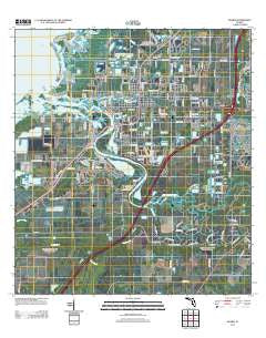
~ Ruskin FL topo map, 1:24000 scale, 7.5 X 7.5 Minute, Historical, 2012
Ruskin, Florida, USGS topographic map dated 2012.
Includes geographic coordinates (latitude and longitude). This topographic map is suitable for hiking, camping, and exploring, or framing it as a wall map.
Printed on-demand using high resolution imagery, on heavy weight and acid free paper, or alternatively on a variety of synthetic materials.
Topos available on paper, Waterproof, Poly, or Tyvek. Usually shipping rolled, unless combined with other folded maps in one order.
- Product Number: USGS-5676066
- Free digital map download (high-resolution, GeoPDF): Ruskin, Florida (file size: 21 MB)
- Map Size: please refer to the dimensions of the GeoPDF map above
- Weight (paper map): ca. 55 grams
- Map Type: POD USGS Topographic Map
- Map Series: US Topo
- Map Verison: Historical
- Cell ID: 38981
- Datum: North American Datum of 1983
- Map Projection: Transverse Mercator
- Map Cell Name: Ruskin
- Grid size: 7.5 X 7.5 Minute
- Date on map: 2012
- Map Scale: 1:24000
- Geographical region: Florida, United States
Neighboring Maps:
All neighboring USGS topo maps are available for sale online at a variety of scales.
Spatial coverage:
Topo map Ruskin, Florida, covers the geographical area associated the following places:
- Point Heron - Sandpiper Point - Bayou Pass Village - Lillie Estates - Pelican Point - Byrd Acres - Covina at Bay Park - Gaudys Paradise - Maplewood - North Branch Shores - Sheron Lee Estates - River Bend - Flournoy - Mays - College Chase - Fairmont Park - Manatee Harbor - Little Manatee Heights - Green Acres - River Shore Farms - Sun City - Rowell Place - Myrtle Tree - Kims Cove - Ruskin Colony Estates - Montero Village - Harbour Isles - Thea Simmons - Cypress Creek Village - Lost River Preserve - Mill Highlands - Elizabeth Acres - Rowell - Ruskin Inlet - Sanctuary Estates - Spyglass at River Bend - Gulf City - Gull Haven - Wellington South at Bay Park - Amanda - Doerr - Mira Lago West - Venetian at Bay Park - Collura - Chalaiman Estates - Hamton - Sable Cove - Saffold Park - Onstott Acres - Pirates Point - Campus Shores - Netherland - Selnerville - Leon - Sill Manor - Marquette - Fairmont Mobile Estates - Calusa Bay - River Oaks - Twin Lake - Braemar - Park Village - Blackstone at Bay Park - Sundance Trails Phase 1 - Bahia Beach - Shooks Folly - Wolf Branch - Sundance - Winding Creek - Careys Pirate Point - Solitude - Wellington North at Bay Park - Ruskin Colony Farms - Ruskin
- Map Area ID: AREA27.7527.625-82.5-82.375
- Northwest corner Lat/Long code: USGSNW27.75-82.5
- Northeast corner Lat/Long code: USGSNE27.75-82.375
- Southwest corner Lat/Long code: USGSSW27.625-82.5
- Southeast corner Lat/Long code: USGSSE27.625-82.375
- Northern map edge Latitude: 27.75
- Southern map edge Latitude: 27.625
- Western map edge Longitude: -82.5
- Eastern map edge Longitude: -82.375


