
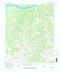
~ Tanana B 1 AK topo map, 1:63360 scale, 15 X 15 Minute, Historical, 1956, updated 1968
Tanana B 1, Alaska, USGS topographic map dated 1956.
Includes geographic coordinates (latitude and longitude). This topographic map is suitable for hiking, camping, and exploring, or framing it as a wall map.
Printed on-demand using high resolution imagery, on heavy weight and acid free paper, or alternatively on a variety of synthetic materials.
Topos available on paper, Waterproof, Poly, or Tyvek. Usually shipping rolled, unless combined with other folded maps in one order.
- Product Number: USGS-5674160
- Free digital map download (high-resolution, GeoPDF): Tanana B 1, Alaska (file size: 16 MB)
- Map Size: please refer to the dimensions of the GeoPDF map above
- Weight (paper map): ca. 55 grams
- Map Type: POD USGS Topographic Map
- Map Series: HTMC
- Map Verison: Historical
- Cell ID: 63330
- Scan ID: 359788
- Imprint Year: 1968
- Woodland Tint: Yes
- Aerial Photo Year: 1953
- Edit Year: 1968
- Datum: NAD27
- Map Projection: Universal Transverse Mercator
- Map published by United States Geological Survey
- Map Language: English
- Scanner Resolution: 600 dpi
- Map Cell Name: Tanana B-1
- Grid size: 15 X 15 Minute
- Date on map: 1956
- Map Scale: 1:63360
- Geographical region: Alaska, United States
Neighboring Maps:
All neighboring USGS topo maps are available for sale online at a variety of scales.
Spatial coverage:
Topo map Tanana B 1, Alaska, covers the geographical area associated the following places:
- Little Minook Junior Creek - Rock Creek - Idaho Bar - Fortyseven Pup - Ninetytwo Pup - Lost Creek - Yukon Bar - Montana Gulch - Jordan Creek - Ten Pup - Elephant Mountain - Trout Creek - Spruce Creek - Joseph Creek - Triple Creek - Boulder Creek - Aloha Creek - Chapman Creek - California Creek - Hoosier Creek - Sixmile Island - Miller Creek - Granite Creek - Sixmile Creek - Nevada Creek - Florida Creek - Rampart Alaska Native Village Statistical Area - Little Minook Creek - Hunter Creek - Slate Creek - Baldry Mountain - Goldpan Creek - Russian Creek - Ruby Creek - McDonald Bar - Chicken Creek - California Bar
- Map Area ID: AREA65.565.25-150.5-150
- Northwest corner Lat/Long code: USGSNW65.5-150.5
- Northeast corner Lat/Long code: USGSNE65.5-150
- Southwest corner Lat/Long code: USGSSW65.25-150.5
- Southeast corner Lat/Long code: USGSSE65.25-150
- Northern map edge Latitude: 65.5
- Southern map edge Latitude: 65.25
- Western map edge Longitude: -150.5
- Eastern map edge Longitude: -150


