
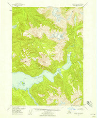
~ Sumdum B 4 AK topo map, 1:63360 scale, 15 X 15 Minute, Historical, 1948, updated 1958
Sumdum B 4, Alaska, USGS topographic map dated 1948.
Includes geographic coordinates (latitude and longitude). This topographic map is suitable for hiking, camping, and exploring, or framing it as a wall map.
Printed on-demand using high resolution imagery, on heavy weight and acid free paper, or alternatively on a variety of synthetic materials.
Topos available on paper, Waterproof, Poly, or Tyvek. Usually shipping rolled, unless combined with other folded maps in one order.
- Product Number: USGS-5673396
- Free digital map download (high-resolution, GeoPDF): Sumdum B 4, Alaska (file size: 12 MB)
- Map Size: please refer to the dimensions of the GeoPDF map above
- Weight (paper map): ca. 55 grams
- Map Type: POD USGS Topographic Map
- Map Series: HTMC
- Map Verison: Historical
- Cell ID: 63078
- Scan ID: 359375
- Imprint Year: 1958
- Woodland Tint: Yes
- Aerial Photo Year: 1948
- Datum: NAD27
- Map Projection: Universal Transverse Mercator
- Map published by United States Geological Survey
- Map Language: English
- Scanner Resolution: 600 dpi
- Map Cell Name: Sumdum B-4
- Grid size: 15 X 15 Minute
- Date on map: 1948
- Map Scale: 1:63360
- Geographical region: Alaska, United States
Neighboring Maps:
All neighboring USGS topo maps are available for sale online at a variety of scales.
Spatial coverage:
Topo map Sumdum B 4, Alaska, covers the geographical area associated the following places:
- Alice Lake - Hobart Bay Census Designated Place - Little Lagoon - The Salt Chuck - Washington Peak - Port Houghton - Walter Island - Rabbit Island - Sandborn Canal - Salt Chuck - North Arm Port Houghton
- Map Area ID: AREA57.557.25-133.3333333-133
- Northwest corner Lat/Long code: USGSNW57.5-133.3333333
- Northeast corner Lat/Long code: USGSNE57.5-133
- Southwest corner Lat/Long code: USGSSW57.25-133.3333333
- Southeast corner Lat/Long code: USGSSE57.25-133
- Northern map edge Latitude: 57.5
- Southern map edge Latitude: 57.25
- Western map edge Longitude: -133.3333333
- Eastern map edge Longitude: -133


