
~ Solomon C 6 AK topo map, 1:63360 scale, 15 X 15 Minute, Historical, 1950, updated 1982
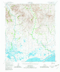
Solomon C 6, Alaska, USGS topographic map dated 1950.
Includes geographic coordinates (latitude and longitude). This topographic map is suitable for hiking, camping, and exploring, or framing it as a wall map.
Printed on-demand using high resolution imagery, on heavy weight and acid free paper, or alternatively on a variety of synthetic materials.
Topos available on paper, Waterproof, Poly, or Tyvek. Usually shipping rolled, unless combined with other folded maps in one order.
- Product Number: USGS-5673284
- Free digital map download (high-resolution, GeoPDF): Solomon C 6, Alaska (file size: 15 MB)
- Map Size: please refer to the dimensions of the GeoPDF map above
- Weight (paper map): ca. 55 grams
- Map Type: POD USGS Topographic Map
- Map Series: HTMC
- Map Verison: Historical
- Cell ID: 62757
- Scan ID: 359311
- Imprint Year: 1982
- Woodland Tint: Yes
- Aerial Photo Year: 1950
- Edit Year: 1982
- Datum: NAD27
- Map Projection: Universal Transverse Mercator
- Map published by United States Geological Survey
- Map published by United States Army Corps of Engineers
- Map published by United States Army
- Map Language: English
- Scanner Resolution: 600 dpi
- Map Cell Name: Solomon C-6
- Grid size: 15 X 15 Minute
- Date on map: 1950
- Map Scale: 1:63360
- Geographical region: Alaska, United States
Neighboring Maps:
All neighboring USGS topo maps are available for sale online at a variety of scales.
Spatial coverage:
Topo map Solomon C 6, Alaska, covers the geographical area associated the following places:
- Carl Creek - Jackson Creek - Ohio Creek - Summit Creek - Goldengate Creek - Solomon Alaska Native Village Statistical Area - Harrison Creek - Beaver Creek - Discovery Creek - Alta Creek - Sunrise Creek - Disappointment Creek - Pajara Creek - Cold Creek - Quartz Creek - California Creek - Fox Lake - Moonlight Creek - Seattle Creek - Brach Creek - Eldorado River - Mulligan Creek - Fox Creek - Volunteer Creek - Eureka Creek - Concord Creek - Gold Creek - OK Creek - Gold Run Creek - Florence Creek - San Jose Creek
- Map Area ID: AREA64.7564.5-165-164.5
- Northwest corner Lat/Long code: USGSNW64.75-165
- Northeast corner Lat/Long code: USGSNE64.75-164.5
- Southwest corner Lat/Long code: USGSSW64.5-165
- Southeast corner Lat/Long code: USGSSE64.5-164.5
- Northern map edge Latitude: 64.75
- Southern map edge Latitude: 64.5
- Western map edge Longitude: -165
- Eastern map edge Longitude: -164.5


