
~ Seward D 4 AK topo map, 1:63360 scale, 15 X 15 Minute, Historical, 1995, updated 1999
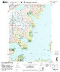
Seward D 4, Alaska, USGS topographic map dated 1995.
Includes geographic coordinates (latitude and longitude). This topographic map is suitable for hiking, camping, and exploring, or framing it as a wall map.
Printed on-demand using high resolution imagery, on heavy weight and acid free paper, or alternatively on a variety of synthetic materials.
Topos available on paper, Waterproof, Poly, or Tyvek. Usually shipping rolled, unless combined with other folded maps in one order.
- Product Number: USGS-5672676
- Free digital map download (high-resolution, GeoPDF): Seward D 4, Alaska (file size: 16 MB)
- Map Size: please refer to the dimensions of the GeoPDF map above
- Weight (paper map): ca. 55 grams
- Map Type: POD USGS Topographic Map
- Map Series: HTMC
- Map Verison: Historical
- Cell ID: 72951
- Scan ID: 358998
- Imprint Year: 1999
- Woodland Tint: Yes
- Aerial Photo Year: 1988
- Edit Year: 1995
- Datum: NAD27
- Map Projection: Transverse Mercator
- Map published by United States Geological Survey
- Map published by United States Forest Service
- Map Language: English
- Scanner Resolution: 600 dpi
- Map Cell Name: Seward D-4
- Grid size: 15 X 15 Minute
- Date on map: 1995
- Map Scale: 1:63360
- Geographical region: Alaska, United States
Neighboring Maps:
All neighboring USGS topo maps are available for sale online at a variety of scales.
Spatial coverage:
Topo map Seward D 4, Alaska, covers the geographical area associated the following places:
- Harrison Lagoon - Decision Point State Marine Park - Lansing Mine - Point Pigot Light - Bettles Bay - Pigot Bay Cabin - Point Cochrane - Entry Cove - Hummer Creek - Ziegler Cove State Marine Park - Port Wells - Slope Point - Wedge Glacier - Surprise Cove - Strong Point - Pigot Glacier - Point Esther - Hollow Bight - Point Culross - Logging Camp Bay - Ziegler Cove - Squirrel Point - Dirty Glacier - Bettles Glacier - Decision Point - Bettles Bay State Marine Park - Pirate Cove - Granite Mine - Point Pigot - Surprise Cove State Marine Park - Esther Rock - Pigot Bay - Entry Cove State Marine Park - Squirrel Cove - Hobo Creek - Lagoon Creek - Blackstone Point - Hummer Bay - Hobo Bay
- Map Area ID: AREA6160.75-148.5-148.125
- Northwest corner Lat/Long code: USGSNW61-148.5
- Northeast corner Lat/Long code: USGSNE61-148.125
- Southwest corner Lat/Long code: USGSSW60.75-148.5
- Southeast corner Lat/Long code: USGSSE60.75-148.125
- Northern map edge Latitude: 61
- Southern map edge Latitude: 60.75
- Western map edge Longitude: -148.5
- Eastern map edge Longitude: -148.125


