
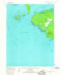
~ Prince Rupert D 5 AK topo map, 1:63360 scale, 15 X 15 Minute, Historical, 1955, updated 1967
Prince Rupert D 5, Alaska, USGS topographic map dated 1955.
Includes geographic coordinates (latitude and longitude). This topographic map is suitable for hiking, camping, and exploring, or framing it as a wall map.
Printed on-demand using high resolution imagery, on heavy weight and acid free paper, or alternatively on a variety of synthetic materials.
Topos available on paper, Waterproof, Poly, or Tyvek. Usually shipping rolled, unless combined with other folded maps in one order.
- Product Number: USGS-5671812
- Free digital map download (high-resolution, GeoPDF): Prince Rupert D 5, Alaska (file size: 6 MB)
- Map Size: please refer to the dimensions of the GeoPDF map above
- Weight (paper map): ca. 55 grams
- Map Type: POD USGS Topographic Map
- Map Series: HTMC
- Map Verison: Historical
- Cell ID: 73129
- Scan ID: 358562
- Imprint Year: 1967
- Woodland Tint: Yes
- Aerial Photo Year: 1948
- Edit Year: 1966
- Datum: NAD27
- Map Projection: Universal Transverse Mercator
- Map published by United States Geological Survey
- Map Language: English
- Scanner Resolution: 600 dpi
- Map Cell Name: Prince Rupert D-5
- Grid size: 15 X 15 Minute
- Date on map: 1955
- Map Scale: 1:63360
- Geographical region: Alaska, United States
Neighboring Maps:
All neighboring USGS topo maps are available for sale online at a variety of scales.
Spatial coverage:
Topo map Prince Rupert D 5, Alaska, covers the geographical area associated the following places:
- Point White - East Bee Rock - Tamgas Reef - West Bee Rock - Julius Reef - Hotspur Island - Hall Cove - Cow Island - Vegas Islands - Helen Island - Mount Lazaro - Club Rocks - Hassler Reef - Werlick Island - Percy Islands - Drug Island - Point Percy - Point Davidson - Bee Rocks - Ryus Bay - Duke Island - Emmet Island - Vancouver Island - Cape Northumberland - Orchard Lake - Sealed Passage - Vegas Island - West Rock - Form Point - Sealing Reef - Niquette Harbor - Roy Island - Goose Tongue Island - Dog Bay - White Rock - Ruth Island
- Map Area ID: AREA5554.75-131.6666667-131.3333333
- Northwest corner Lat/Long code: USGSNW55-131.6666667
- Northeast corner Lat/Long code: USGSNE55-131.3333333
- Southwest corner Lat/Long code: USGSSW54.75-131.6666667
- Southeast corner Lat/Long code: USGSSE54.75-131.3333333
- Northern map edge Latitude: 55
- Southern map edge Latitude: 54.75
- Western map edge Longitude: -131.6666667
- Eastern map edge Longitude: -131.3333333


