
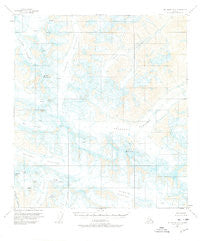
~ Mount Hayes B 3 AK topo map, 1:63360 scale, 15 X 15 Minute, Historical, 1955, updated 1976
Mount Hayes B 3, Alaska, USGS topographic map dated 1955.
Includes geographic coordinates (latitude and longitude). This topographic map is suitable for hiking, camping, and exploring, or framing it as a wall map.
Printed on-demand using high resolution imagery, on heavy weight and acid free paper, or alternatively on a variety of synthetic materials.
Topos available on paper, Waterproof, Poly, or Tyvek. Usually shipping rolled, unless combined with other folded maps in one order.
- Product Number: USGS-5670046
- Free digital map download (high-resolution, GeoPDF): Mount Hayes B 3, Alaska (file size: 13 MB)
- Map Size: please refer to the dimensions of the GeoPDF map above
- Weight (paper map): ca. 55 grams
- Map Type: POD USGS Topographic Map
- Map Series: HTMC
- Map Verison: Historical
- Cell ID: 58000
- Scan ID: 357647
- Imprint Year: 1976
- Aerial Photo Year: 1954
- Edit Year: 1963
- Datum: NAD27
- Map Projection: Universal Transverse Mercator
- Map published by United States Geological Survey
- Map Language: English
- Scanner Resolution: 600 dpi
- Map Cell Name: Mount Hayes B-3
- Grid size: 15 X 15 Minute
- Date on map: 1955
- Map Scale: 1:63360
- Geographical region: Alaska, United States
Neighboring Maps:
All neighboring USGS topo maps are available for sale online at a variety of scales.
Spatial coverage:
Topo map Mount Hayes B 3, Alaska, covers the geographical area associated the following places:
- Icefall Peak - Mount Gakona - Canwell Glacier - Thorkona - Old Snowy - The Thorn - Sight Peak - Minya Peak - College Glacier - Snow White - Eel Glacier - Pegmatite Glacier - Johnson Glacier - Skull Peak - Cony Mountain - Spur Glacier - Gulkana Glacier - Gabriel Icefall - Ogive Mountain - M'Ladies Mountain - Moore Icefall - Tusac - Gerstle Glacier - Black Cap - Institute Peak - White Princess
- Map Area ID: AREA63.563.25-145.5-145
- Northwest corner Lat/Long code: USGSNW63.5-145.5
- Northeast corner Lat/Long code: USGSNE63.5-145
- Southwest corner Lat/Long code: USGSSW63.25-145.5
- Southeast corner Lat/Long code: USGSSE63.25-145
- Northern map edge Latitude: 63.5
- Southern map edge Latitude: 63.25
- Western map edge Longitude: -145.5
- Eastern map edge Longitude: -145


