
~ Craig D 2 AK topo map, 1:63360 scale, 15 X 15 Minute, Historical, 1994, updated 1998
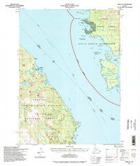
Craig D 2, Alaska, USGS topographic map dated 1994.
Includes geographic coordinates (latitude and longitude). This topographic map is suitable for hiking, camping, and exploring, or framing it as a wall map.
Printed on-demand using high resolution imagery, on heavy weight and acid free paper, or alternatively on a variety of synthetic materials.
Topos available on paper, Waterproof, Poly, or Tyvek. Usually shipping rolled, unless combined with other folded maps in one order.
- Product Number: USGS-5665438
- Free digital map download (high-resolution, GeoPDF): Craig D 2, Alaska (file size: 14 MB)
- Map Size: please refer to the dimensions of the GeoPDF map above
- Weight (paper map): ca. 55 grams
- Map Type: POD USGS Topographic Map
- Map Series: HTMC
- Map Verison: Historical
- Cell ID: 53046
- Scan ID: 355318
- Imprint Year: 1998
- Woodland Tint: Yes
- Aerial Photo Year: 1991
- Datum: NAD27
- Map Projection: Transverse Mercator
- Map published by United States Geological Survey
- Map published by United States Forest Service
- Map Language: English
- Scanner Resolution: 600 dpi
- Map Cell Name: Craig D-2
- Grid size: 15 X 15 Minute
- Date on map: 1994
- Map Scale: 1:63360
- Geographical region: Alaska, United States
Neighboring Maps:
All neighboring USGS topo maps are available for sale online at a variety of scales.
Spatial coverage:
Topo map Craig D 2, Alaska, covers the geographical area associated the following places:
- Dewey Anchorage - Onslow Island - Mabel Island - Krogh Lake - Ratz Harbor - Kelp Point - Carlton Island - Trumpeter Lake - Big Lake - Clarence Strait - McHenry Anchorage - Entrance Island - Ratz Creek - Ernest Point - Gull Point - Sal Creek - Split Island - Slide Creek - Center Island - Little Ratz Harbor - Quartz Rock - Little Ratz Creek - Ratz Point - Narrow Point - Double Island - Avon Island
- Map Area ID: AREA5655.75-132.6666667-132.3333333
- Northwest corner Lat/Long code: USGSNW56-132.6666667
- Northeast corner Lat/Long code: USGSNE56-132.3333333
- Southwest corner Lat/Long code: USGSSW55.75-132.6666667
- Southeast corner Lat/Long code: USGSSE55.75-132.3333333
- Northern map edge Latitude: 56
- Southern map edge Latitude: 55.75
- Western map edge Longitude: -132.6666667
- Eastern map edge Longitude: -132.3333333


