
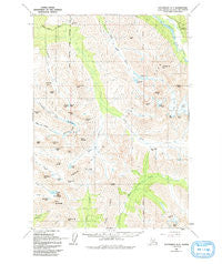
~ Anchorage A 7 AK topo map, 1:63360 scale, 15 X 15 Minute, Historical, 1960, updated 1993
Anchorage A 7, Alaska, USGS topographic map dated 1960.
Includes geographic coordinates (latitude and longitude). This topographic map is suitable for hiking, camping, and exploring, or framing it as a wall map.
Printed on-demand using high resolution imagery, on heavy weight and acid free paper, or alternatively on a variety of synthetic materials.
Topos available on paper, Waterproof, Poly, or Tyvek. Usually shipping rolled, unless combined with other folded maps in one order.
- Product Number: USGS-5662666
- Free digital map download (high-resolution, GeoPDF): Anchorage A 7, Alaska (file size: 14 MB)
- Map Size: please refer to the dimensions of the GeoPDF map above
- Weight (paper map): ca. 55 grams
- Map Type: POD USGS Topographic Map
- Map Series: HTMC
- Map Verison: Historical
- Cell ID: 50549
- Scan ID: 361718
- Imprint Year: 1993
- Woodland Tint: Yes
- Visual Version Number: 1
- Aerial Photo Year: 1957
- Edit Year: 1974
- Datum: NAD27
- Map Projection: Transverse Mercator
- Map published by United States Geological Survey
- Map Language: English
- Scanner Resolution: 600 dpi
- Map Cell Name: Anchorage A-7
- Grid size: 15 X 15 Minute
- Date on map: 1960
- Map Scale: 1:63360
- Geographical region: Alaska, United States
Neighboring Maps:
All neighboring USGS topo maps are available for sale online at a variety of scales.
Spatial coverage:
Topo map Anchorage A 7, Alaska, covers the geographical area associated the following places:
- Symphony Lake - Bird Peak - Long Lake - Eagle Lake - Indianhouse Mountain - Harp Mountain - Indian Creek Pass - Cantata Peak - Hardee Field (historical) - Falling Water Creek - Little Teton Mountain - Mount Williwaw - Wolverine Peak - Ship Lake - Powerline Pass - Tanaina Lake - Hidden Lake - Calliope Mountain - Temptation Peak - Hurdygurdy Mountain - South Fork Volunteer Fire Department - Chugach State Park - Bird Glacier - Ptarmigan Peak - The Ramp - The Wedge - Eagle Peak - O'Malley Peak - Suicide Peaks - Tanaina Peak - Rabbit Lake - Bird Creek Pass - Williwan Lakes - North Fork Ship Creek - Flute Glacier
- Map Area ID: AREA61.2561-149.625-149.25
- Northwest corner Lat/Long code: USGSNW61.25-149.625
- Northeast corner Lat/Long code: USGSNE61.25-149.25
- Southwest corner Lat/Long code: USGSSW61-149.625
- Southeast corner Lat/Long code: USGSSE61-149.25
- Northern map edge Latitude: 61.25
- Southern map edge Latitude: 61
- Western map edge Longitude: -149.625
- Eastern map edge Longitude: -149.25


