
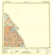
~ Taku River AK topo map, 1:250000 scale, 1 X 2 Degree, Historical, 1953, updated 1953
Taku River, Alaska, USGS topographic map dated 1953.
Includes geographic coordinates (latitude and longitude). This topographic map is suitable for hiking, camping, and exploring, or framing it as a wall map.
Printed on-demand using high resolution imagery, on heavy weight and acid free paper, or alternatively on a variety of synthetic materials.
Topos available on paper, Waterproof, Poly, or Tyvek. Usually shipping rolled, unless combined with other folded maps in one order.
- Product Number: USGS-5662120
- Free digital map download (high-resolution, GeoPDF): Taku River, Alaska (file size: 13 MB)
- Map Size: please refer to the dimensions of the GeoPDF map above
- Weight (paper map): ca. 55 grams
- Map Type: POD USGS Topographic Map
- Map Series: HTMC
- Map Verison: Historical
- Cell ID: 69042
- Scan ID: 361497
- Imprint Year: 1953
- Visual Version Number: 1
- Aerial Photo Year: 1948
- Datum: NAD27
- Map Projection: Universal Transverse Mercator
- Map published by United States Geological Survey
- Map Language: English
- Scanner Resolution: 600 dpi
- Map Cell Name: Taku River
- Grid size: 1 X 2 Degree
- Date on map: 1953
- Map Scale: 1:250000
- Geographical region: Alaska, United States
Neighboring Maps:
All neighboring USGS topo maps are available for sale online at a variety of scales.
Spatial coverage:
Topo map Taku River, Alaska, covers the geographical area associated the following places:
- Lake Dorothy - Canyon Island - Tease Reservoir - Bride Point - Ivy Ridge - Johnson Creek - Prospect Point - Speel Lake (historical) - Hades Highway - Fillmore Peak - Wright Peaks - Webster Peak - Wright Glacier - Moose Creek - Long Lake - Everett Peak - Whiting Point - Boundary Lake - Sockeye Creek - Tease Lake Dam - Kluchman Mountain - Bullards Landing - Sittakanay River - West Twin Glacier - Prospect Creek - Steeple Peak - Indian Lake - Fish Creek - Arthur Peak - Crater Creek - Taku Lodge Seaplane Base - East Twin Glacier - Coast Mountains - Tease Lake - The Gorge - Limestone Bluffs - Mount Brundage - Frostbite Peak - Snow Tower - Speel Arm - Couloir Peak - Crater Lake - Gisel Peak - Yehring Creek - Limestone Creek - The Horn Peaks - Crib Point - Boundary Peak 79 - Antler Peaks - Twin Glacier Peak - Camp 4 Peak - Taku Lodge - Turner Lake - Bridge Glacier - Crescent Lake - Devils Paw - Speel River - Long Lake - Twin Glacier Lake - Speel River - Long River - Mount Hill - Snettisham Dam - Swineford Lakes - Snettisham Airport - Port Snettisham - Mount Swineford - Limestone Inlet - Mallard Cove - Michaels Sword - Sharp Point - Boundary Creek - Wright River - Speel Point - Ox Point - Boundary Peak 83 - Taku River - Star Point - Campion Ditch - Mount Fremont Morse - Glacier Creek - Limestone Inlet Research Natural Area - Bacon Glacier - Swede Point - Speel Glacier - Bogert Point - Whigg Placer Mine - Davidson Creek - Fannie Island - Mount Ogden - Unknown Glacier - Turner Creek - Hidden Creek
- Map Area ID: AREA5958-134-132
- Northwest corner Lat/Long code: USGSNW59-134
- Northeast corner Lat/Long code: USGSNE59-132
- Southwest corner Lat/Long code: USGSSW58-134
- Southeast corner Lat/Long code: USGSSE58-132
- Northern map edge Latitude: 59
- Southern map edge Latitude: 58
- Western map edge Longitude: -134
- Eastern map edge Longitude: -132


