
~ Table Mountain AK topo map, 1:250000 scale, 1 X 3 Degree, Historical, 1956
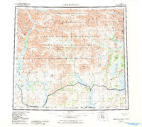
Table Mountain, Alaska, USGS topographic map dated 1956.
Includes geographic coordinates (latitude and longitude). This topographic map is suitable for hiking, camping, and exploring, or framing it as a wall map.
Printed on-demand using high resolution imagery, on heavy weight and acid free paper, or alternatively on a variety of synthetic materials.
Topos available on paper, Waterproof, Poly, or Tyvek. Usually shipping rolled, unless combined with other folded maps in one order.
- Product Number: USGS-5662114
- Free digital map download (high-resolution, GeoPDF): Table Mountain, Alaska (file size: 31 MB)
- Map Size: please refer to the dimensions of the GeoPDF map above
- Weight (paper map): ca. 55 grams
- Map Type: POD USGS Topographic Map
- Map Series: HTMC
- Map Verison: Historical
- Cell ID: 75065
- Scan ID: 707876
- Woodland Tint: Yes
- Aerial Photo Year: 1981
- Edit Year: 1984
- Datum: NAD27
- Map Projection: Universal Transverse Mercator
- Map published by United States Geological Survey
- Map Language: English
- Scanner Resolution: 508 dpi
- Map Cell Name: Table Mountain
- Grid size: 1 X 3 Degree
- Date on map: 1956
- Map Scale: 1:250000
- Geographical region: Alaska, United States
Neighboring Maps:
All neighboring USGS topo maps are available for sale online at a variety of scales.
Spatial coverage:
Topo map Table Mountain, Alaska, covers the geographical area associated the following places:
- Boulevard Creek - Kaultuinjek Creek - Helen Creek - Horse Hill - Galena Creek - Continental Divide - Double Mountain - East Fork Sheenjek River - Kaultui Mountain - Yankee Ridge - Table Mountain - Ammerman Creek - Conglomerate Mountain - Eskimo Creek - Kuirzinjik Lake - Old Woman Creek - Conglomerate Mountain - Lois Creek - Black Mountain - Mancha Creek - Ambresvajun Lake - Sheenjek Lake - Ammerman Mountain - Bear Mountain - Davidson Mountains
- Map Area ID: AREA6968-144-141
- Northwest corner Lat/Long code: USGSNW69-144
- Northeast corner Lat/Long code: USGSNE69-141
- Southwest corner Lat/Long code: USGSSW68-144
- Southeast corner Lat/Long code: USGSSE68-141
- Northern map edge Latitude: 69
- Southern map edge Latitude: 68
- Western map edge Longitude: -144
- Eastern map edge Longitude: -141


