
~ Russian Mission AK topo map, 1:250000 scale, 1 X 3 Degree, Historical, 1947, updated 1976
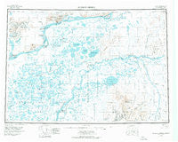
Russian Mission, Alaska, USGS topographic map dated 1947.
Includes geographic coordinates (latitude and longitude). This topographic map is suitable for hiking, camping, and exploring, or framing it as a wall map.
Printed on-demand using high resolution imagery, on heavy weight and acid free paper, or alternatively on a variety of synthetic materials.
Topos available on paper, Waterproof, Poly, or Tyvek. Usually shipping rolled, unless combined with other folded maps in one order.
- Product Number: USGS-5661838
- Free digital map download (high-resolution, GeoPDF): Russian Mission, Alaska (file size: 24 MB)
- Map Size: please refer to the dimensions of the GeoPDF map above
- Weight (paper map): ca. 55 grams
- Map Type: POD USGS Topographic Map
- Map Series: HTMC
- Map Verison: Historical
- Cell ID: 68998
- Scan ID: 361355
- Imprint Year: 1976
- Edit Year: 1972
- Survey Year: 1946
- Datum: NAD27
- Map Projection: Universal Transverse Mercator
- Map published by United States Geological Survey
- Map Language: English
- Scanner Resolution: 600 dpi
- Map Cell Name: Russian Mission
- Grid size: 1 X 3 Degree
- Date on map: 1947
- Map Scale: 1:250000
- Geographical region: Alaska, United States
Neighboring Maps:
All neighboring USGS topo maps are available for sale online at a variety of scales.
Spatial coverage:
Topo map Russian Mission, Alaska, covers the geographical area associated the following places:
- Willow Creek - Kakamut - Toklik - Aniak - Dogfish Village - Ikatlek (historical) - Taguta (historical) - Ingregamiut (historical) - Tiengak (historical) - Tuluksak - Ribnaia (historical) - Paimiut - Ohogamiut - Tuluka (historical) - Kalskag - Uknavik - Lower Kalskag - Nyac - Tuckers - Kako Landing - Oknagamut (historical) - Chuathbaluk - Russian Mission - Tuklak (historical)
- Map Area ID: AREA6261-162-159
- Northwest corner Lat/Long code: USGSNW62-162
- Northeast corner Lat/Long code: USGSNE62-159
- Southwest corner Lat/Long code: USGSSW61-162
- Southeast corner Lat/Long code: USGSSE61-159
- Northern map edge Latitude: 62
- Southern map edge Latitude: 61
- Western map edge Longitude: -162
- Eastern map edge Longitude: -159


