
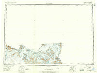
~ Mt Saint Elias AK topo map, 1:250000 scale, 1 X 3 Degree, Historical, 1951, updated 1958
Mt Saint Elias, Alaska, USGS topographic map dated 1951.
Includes geographic coordinates (latitude and longitude). This topographic map is suitable for hiking, camping, and exploring, or framing it as a wall map.
Printed on-demand using high resolution imagery, on heavy weight and acid free paper, or alternatively on a variety of synthetic materials.
Topos available on paper, Waterproof, Poly, or Tyvek. Usually shipping rolled, unless combined with other folded maps in one order.
- Product Number: USGS-5661560
- Free digital map download (high-resolution, GeoPDF): Mt Saint Elias, Alaska (file size: 17 MB)
- Map Size: please refer to the dimensions of the GeoPDF map above
- Weight (paper map): ca. 55 grams
- Map Type: POD USGS Topographic Map
- Map Series: HTMC
- Map Verison: Historical
- Cell ID: 68925
- Scan ID: 361193
- Imprint Year: 1958
- Datum: NAD27
- Map Projection: Universal Transverse Mercator
- Map published by United States Geological Survey
- Map Language: English
- Scanner Resolution: 600 dpi
- Map Cell Name: Mount Saint Elias
- Grid size: 1 X 3 Degree
- Date on map: 1951
- Map Scale: 1:250000
- Geographical region: Alaska, United States
Neighboring Maps:
All neighboring USGS topo maps are available for sale online at a variety of scales.
Spatial coverage:
Topo map Mt Saint Elias, Alaska, covers the geographical area associated the following places:
- Pinnacle Pass - Haenke Glacier - Blossom Glacier - Libbey Glacier - Mount Alverstone - Boundary Peak 187 - Valerie Glacier - Augusta Glacier - Moore Nunatak - Oily Lake - Mount Vancouver - Icefield Ranges - Saint Elias Mountains - Boundary Peak 185 - Pinnacle Glacier - Agassiz Lakes - Mount Foresta - Mount Saint Elias - Boundary Peak 184 - Agassiz Glacier - Hitchcock Glacier - Alverstone Glacier - Turner Glacier - Point Glorious - Mount Owen - Haydon Peak - Mount Hubbard - Hitchcock Hills - Mount Cook - Mount Seattle - Dome Pass - Mount Augusta - Miller Glacier - Centennial Range - Lucia Glacier - Hubbard Glacier - Samovar Hills - Pinnacle Pass Hills - Hayden Glacier - Blossom Island
- Map Area ID: AREA6160-141-138
- Northwest corner Lat/Long code: USGSNW61-141
- Northeast corner Lat/Long code: USGSNE61-138
- Southwest corner Lat/Long code: USGSSW60-141
- Southeast corner Lat/Long code: USGSSE60-138
- Northern map edge Latitude: 61
- Southern map edge Latitude: 60
- Western map edge Longitude: -141
- Eastern map edge Longitude: -138


