
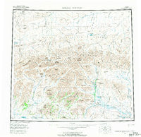
~ Misheguk Mountain AK topo map, 1:250000 scale, 1 X 3 Degree, Historical, 1956, updated 1970
Misheguk Mountain, Alaska, USGS topographic map dated 1956.
Includes geographic coordinates (latitude and longitude). This topographic map is suitable for hiking, camping, and exploring, or framing it as a wall map.
Printed on-demand using high resolution imagery, on heavy weight and acid free paper, or alternatively on a variety of synthetic materials.
Topos available on paper, Waterproof, Poly, or Tyvek. Usually shipping rolled, unless combined with other folded maps in one order.
- Product Number: USGS-5661494
- Free digital map download (high-resolution, GeoPDF): Misheguk Mountain, Alaska (file size: 29 MB)
- Map Size: please refer to the dimensions of the GeoPDF map above
- Weight (paper map): ca. 55 grams
- Map Type: POD USGS Topographic Map
- Map Series: HTMC
- Map Verison: Historical
- Cell ID: 68914
- Scan ID: 361168
- Imprint Year: 1970
- Woodland Tint: Yes
- Aerial Photo Year: 1956
- Datum: NAD27
- Map Projection: Universal Transverse Mercator
- Map published by United States Geological Survey
- Map Language: English
- Scanner Resolution: 600 dpi
- Map Cell Name: Misheguk Mountain
- Grid size: 1 X 3 Degree
- Date on map: 1956
- Map Scale: 1:250000
- Geographical region: Alaska, United States
Neighboring Maps:
All neighboring USGS topo maps are available for sale online at a variety of scales.
Spatial coverage:
Topo map Misheguk Mountain, Alaska, covers the geographical area associated the following places:
- Tupik Mountain - Ignisirok Creek - Rabbit Ears - Sorepaw Creek - Kamiktungitak Creek - Lake Tutusirok - Lake Narvakrak - Kuruk Creek - Imikneyak Mountain - Nuka Ridge - Noatak National Preserve - Kantangnak Creek - Suvaloyuk Creek - Inaccessible Ridge - Shulunarurak Creek - Ilingnorak Ridge - Isacheluich Mountains - Thunder Creek - Rhumba Creek - Akaluovik Lakes - Okotak Creek - Uchugrak Hills - Poktovik Creek - Aglungak Hills - Noatak Wilderness - Copter Peak - Imikneyak Creek - Itimtikrak Creek - Nunaviksak Creek - Arotak Creek - Nucleus Creek - Kokolik Lake - Ukpik Creek - De Long Mountains - Klim Creek - Little Cottonwood Creek - Storm Creek - Elbow Creek - Chertchip Creek - Sphinx Mountain - Kuyak Creek - Kagvik Creek - Tumit Creek - Tupik Creek - Nimiuktuk River - Amaktukvik Pass - New Cottonwood Creek - Mechanic Creek - Pattern Creek - Avgun Hills - Kingasivik Mountains - Nunaviksak Creek - Seagull Creek - Sisiak Creek - Okoklik Lake - Tupikchak Creek - Kidney Creek - Kukukpilak Creek - Ignisirok Creek - Nucleus Mountain - Plunge Creek - Singayoak Creek - Kogruk Creek - Lake Kaiyak - Natinakunit Pass - Pilly Fork - Adventure Creek - Amo Creek - Misheguk Mountain - Poktovik Mountains - Thunder Mountain - Setting Sun Creek - Driftwood Creek - Imikneyak Mountains - Spike Creek - Sulungatak Ridge - Puutik Mountain - Cairn Creek - Picnic Creek - Aniralik Lake - Plunge Creek - Nimwutik Creek - Trail Creek - Iggiruk Mountains - Echo Mountain - Meat Mountain - Nachralik Pass - Burial Lake - Stone Ring Creek - Tupikchak Mountain - Black Mountain - Mount Bastille - Analak Creek - Nullaq Lake - Kingaviksak Mountain
- Map Area ID: AREA6968-162-159
- Northwest corner Lat/Long code: USGSNW69-162
- Northeast corner Lat/Long code: USGSNE69-159
- Southwest corner Lat/Long code: USGSSW68-162
- Southeast corner Lat/Long code: USGSSE68-159
- Northern map edge Latitude: 69
- Southern map edge Latitude: 68
- Western map edge Longitude: -162
- Eastern map edge Longitude: -159


