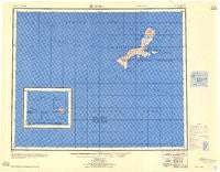
~ Kiska AK topo map, 1:250000 scale, 1 X 2 Degree, Historical, 1958, updated 1958
Kiska, Alaska, USGS topographic map dated 1958.
Includes geographic coordinates (latitude and longitude). This topographic map is suitable for hiking, camping, and exploring, or framing it as a wall map.
Printed on-demand using high resolution imagery, on heavy weight and acid free paper, or alternatively on a variety of synthetic materials.
Topos available on paper, Waterproof, Poly, or Tyvek. Usually shipping rolled, unless combined with other folded maps in one order.
- Product Number: USGS-5661288
- Free digital map download (high-resolution, GeoPDF): Kiska, Alaska (file size: 25 MB)
- Map Size: please refer to the dimensions of the GeoPDF map above
- Weight (paper map): ca. 55 grams
- Map Type: POD USGS Topographic Map
- Map Series: HTMC
- Map Verison: Historical
- Cell ID: 76868
- Scan ID: 707800
- Imprint Year: 1958
- Aerial Photo Year: 1947
- Datum: NAD27
- Map Projection: Transverse Mercator
- Map published by United States Army Corps of Engineers
- Map published by United States Army
- Keywords: Inset
- Map Language: English
- Scanner Resolution: 508 dpi
- Map Cell Name: Kiska
- Grid size: 1 X 2 Degree
- Date on map: 1958
- Map Scale: 1:250000
- Geographical region: Alaska, United States
Neighboring Maps:
All neighboring USGS topo maps are available for sale online at a variety of scales.
Spatial coverage:
Topo map Kiska, Alaska, covers the geographical area associated the following places:
- Cloudy Pass - Lunatic Lake - Lazy Creek - Majority Creek - Kernel Cove - Wolf Point - Cotton Cove - Meteor Hill - Angel Cove - Summer Cove - North Head - Lard Hill - Bukhti Point - Fresh Creek - Rex Hill - Link Hills - Leather Lake - Hammer Point - Spring Cove - Canary Beach - Arrow Lake - Conquer Point - Mill Hill - Blue Jay Rock - Rich Creek - Loyal Hills - Barley Cove - Major Creek - Sugar Hill - Maiden Lake - Morgan Hill - Yug Point - Green Lake - Goat Hill - Faith Hill - Russian Ridge - Leaky Lake - Rattlesnake Ridge - Quisling Cove - Ring Lake - Broad Beach - Random Creek - Look Lake - Rapid Lake - Loon Creek - Lead Hill - April Inlet - Foot Mountain - Monsoon Lake - Rainy Pass - Gentle Lake - Ford Hill - Kitten Creek - Labor Hill - Metal Hill - Freak Lake - Moron Lake - McArthur Pass - Funeral Ridge - Log Lakes - Fork Hill - Far Hill - Sea Lion Pass - Faint Mountain - Map Hill - Conquer Bay - Louse Creek - Germ Hill - Little Kiska Head - Lash Hills - Loren Hill - Persian Ridge - Farmer Hill - X-Wave Creek - Nazi Creek - Fantasy Knob - Larry Hill - Kennel Lakes - Christine Lake - Sub Point - Rich Hill - Locust Hill - Leo Hill - Ethel Cove - Gander Hill - Japanese Occupation Site-Kiska Island - Lousy Hill - Lodge Lake - Fawn Hill - Vega Point - Latch Hill - Buldir Reef - Loot Hill - Williwaw Pass - Hamburger Point - Haycock Rock - Gaudy Lake - Nude Hill - Foggy Hill - X-Ray Ridge
- Map Area ID: AREA52.2551.25176178
- Northwest corner Lat/Long code: USGSNW52.25176
- Northeast corner Lat/Long code: USGSNE52.25178
- Southwest corner Lat/Long code: USGSSW51.25176
- Southeast corner Lat/Long code: USGSSE51.25178
- Northern map edge Latitude: 52.25
- Southern map edge Latitude: 51.25
- Western map edge Longitude: 176
- Eastern map edge Longitude: 178

