
~ Blying Sound AK topo map, 1:250000 scale, 1 X 3 Degree, Historical, 1953, updated 1974
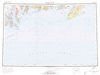
Blying Sound, Alaska, USGS topographic map dated 1953.
Includes geographic coordinates (latitude and longitude). This topographic map is suitable for hiking, camping, and exploring, or framing it as a wall map.
Printed on-demand using high resolution imagery, on heavy weight and acid free paper, or alternatively on a variety of synthetic materials.
Topos available on paper, Waterproof, Poly, or Tyvek. Usually shipping rolled, unless combined with other folded maps in one order.
- Product Number: USGS-5660616
- Free digital map download (high-resolution, GeoPDF): Blying Sound, Alaska (file size: 37 MB)
- Map Size: please refer to the dimensions of the GeoPDF map above
- Weight (paper map): ca. 55 grams
- Map Type: POD USGS Topographic Map
- Map Series: HTMC
- Map Verison: Historical
- Cell ID: 68683
- Scan ID: 360696
- Imprint Year: 1974
- Woodland Tint: Yes
- Aerial Photo Year: 1952
- Edit Year: 1972
- Datum: NAD27
- Map Projection: Universal Transverse Mercator
- Map published by United States Geological Survey
- Map Language: English
- Scanner Resolution: 600 dpi
- Map Cell Name: Blying Sound
- Grid size: 1 X 3 Degree
- Date on map: 1953
- Map Scale: 1:250000
- Geographical region: Alaska, United States
Neighboring Maps:
All neighboring USGS topo maps are available for sale online at a variety of scales.
Spatial coverage:
Topo map Blying Sound, Alaska, covers the geographical area associated the following places:
- Hub Rock - San Juan Bay - Point Woodcock - Dora Passage - Aialik Bay - Aialik Peninsula - Fox Island - Cape Cleare - Natoa Island - Jeanie Creek - Aialik Bay - Danger Island - Koss Cove - Resurrection Bay - Aialik Cape - Stump Lake - Tooth Cove - Rugged Island - Pilot Rock - Addison Glacier - Sandy Bay - Holgate Arm - Humpy Cove - Chat Cove - North Twin Bay - Callisto Head - Three Hole Bay - Bear Glacier Point - Elrington Passage - Puget Bay - Cup Cove - Wooded Islands - Northwestern Fiord - Slate Island - Hanning Bay - Granite Passage - Resurrection Peninsula - Cape Resurrection - Latouche Peak - Marys Rock - Matushka Island - Killer Bay - Ripple Cove - Cape Mansfield - Paradise Cove - Cheval Narrows - Anchor Cove - Three Hole Point - Sandspit Point State Marine Park - Point Bazil - Caines Head State Recreation Area - Harris Point - Toe Point - Fish Island - Holgate Glacier - Bear Lake - Sunny Cove - Box Island - Taz Basin - Point Bryant - Talus Bay - Blying Sound - South Twin Bay - Hat Island - Harris Bay - Pointed Rock - Petes Pass - Porcupine Cove - Holgate Head - Lone Rock - Mount Fairfield - Crater Bay - Lechner Glacier - Skee Glacier - Barwell Island - Braided Creek - Hive Island - Frozen Rock - Jeanie Cove - Elrington Island - Driftwood Bay State Marine Park - Coleman Bay - Marys Bay - Bear Cove - Patton River - Cape Fairfield - Strike Creek - Fort McGilvray (historical) - The Iron Door - Tortuous Creek - Cape Junken - Whidbey Bay - Twin Islands - Fort Bulkley (historical) - Lonetree Point - Chiswell Island - Aialik Glacier - Harbor Island - Pedersen Glacier - Pinnacle Rock
- Map Area ID: AREA6059-150-147
- Northwest corner Lat/Long code: USGSNW60-150
- Northeast corner Lat/Long code: USGSNE60-147
- Southwest corner Lat/Long code: USGSSW59-150
- Southeast corner Lat/Long code: USGSSE59-147
- Northern map edge Latitude: 60
- Southern map edge Latitude: 59
- Western map edge Longitude: -150
- Eastern map edge Longitude: -147


