
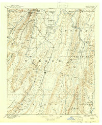
~ Catoosa GA topo map, 1:125000 scale, 30 X 30 Minute, Historical, 1892, updated 1942
Catoosa, Georgia, USGS topographic map dated 1892.
Includes geographic coordinates (latitude and longitude). This topographic map is suitable for hiking, camping, and exploring, or framing it as a wall map.
Printed on-demand using high resolution imagery, on heavy weight and acid free paper, or alternatively on a variety of synthetic materials.
Topos available on paper, Waterproof, Poly, or Tyvek. Usually shipping rolled, unless combined with other folded maps in one order.
- Product Number: USGS-5658287
- Free digital map download (high-resolution, GeoPDF): Catoosa, Georgia (file size: 7 MB)
- Map Size: please refer to the dimensions of the GeoPDF map above
- Weight (paper map): ca. 55 grams
- Map Type: POD USGS Topographic Map
- Map Series: HTMC
- Map Verison: Historical
- Cell ID: 395851
- Scan ID: 247704
- Imprint Year: 1942
- Survey Year: 1885
- Datum: Unstated
- Map Projection: Polyconic
- Map published by United States Geological Survey
- Map Language: English
- Scanner Resolution: 600 dpi
- Map Cell Name: Ringgold
- Grid size: 30 X 30 Minute
- Date on map: 1892
- Map Scale: 1:125000
- Geographical region: Georgia, United States
Neighboring Maps:
All neighboring USGS topo maps are available for sale online at a variety of scales.
Spatial coverage:
Topo map Catoosa, Georgia, covers the geographical area associated the following places:
- Morris Estates - Center Grove - Dillon (historical) - Foster Hills - Piney Woods - New Liberty - LaFayette - Ringgold - Beverly Hills - Chelsea - Summit Hill - High Point - Boyd Highlands - Old Mill Trace - Kesler Hills - Park City - Naomi - Indian Springs - Poplar Springs - Fairlawn Acres - Masseyville - Saint Elmo - Jamesburg - Chickamauga - Hawkins - Cedar Grove - Valley View - Ascalon - Salem (historical) - Martindale - McDonald Acres - Sugar Valley - Haysville - Fairview - Noble - Dafron - Liles Addition - Skyline Heights - Eagle Cliff - Thompsonville - Flintstone - Hall Mill - Warrens (historical) - Shookville - Greenbush (historical) - Beaumount - Subligna - Freetown (historical) - Plum Nelly - Ellie Spring - Walnut Hills - Dewberry Town - Tunnel Hill - Walnut Grove - Rock Spring - Love Hill - Mahan (historical) - Green Acres - Horse Lake Estates - Furnace (historical) - Center Post - Brookvale Estates - Copeland Crossing - Oakton - Burning Bush - Orchard Hills - Mission Oaks - Corinth - Cannon Crossing - Cinderella Hills - Harrisburg - Salem - McCutchen (historical) - East Armuchee - Rock City - White Oak - Stone Church - Blowing Spring - Gerber (historical) - Dickey (historical) - Winwood Forest - Waverly Park - Fort Oglethorpe - Kendrick (historical) - Pinewood Estates - Newnan Springs - East Boynton - Trion - Midway - Linwood - Opeleika (historical) - Warren Terrace - Oak Park - Pennville - Cloudland - East Trion - Hinkles - Rocky Face - Harris Hills - Suttles Mill
- Map Area ID: AREA3534.5-85.5-85
- Northwest corner Lat/Long code: USGSNW35-85.5
- Northeast corner Lat/Long code: USGSNE35-85
- Southwest corner Lat/Long code: USGSSW34.5-85.5
- Southeast corner Lat/Long code: USGSSE34.5-85
- Northern map edge Latitude: 35
- Southern map edge Latitude: 34.5
- Western map edge Longitude: -85.5
- Eastern map edge Longitude: -85


