
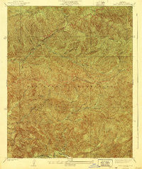
~ Trail Canyon CA topo map, 1:24000 scale, 7.5 X 7.5 Minute, Historical, 1940, updated 1940
Trail Canyon, California, USGS topographic map dated 1940.
Includes geographic coordinates (latitude and longitude). This topographic map is suitable for hiking, camping, and exploring, or framing it as a wall map.
Printed on-demand using high resolution imagery, on heavy weight and acid free paper, or alternatively on a variety of synthetic materials.
Topos available on paper, Waterproof, Poly, or Tyvek. Usually shipping rolled, unless combined with other folded maps in one order.
- Product Number: USGS-5658081
- Free digital map download (high-resolution, GeoPDF): Trail Canyon, California (file size: 15 MB)
- Map Size: please refer to the dimensions of the GeoPDF map above
- Weight (paper map): ca. 55 grams
- Map Type: POD USGS Topographic Map
- Map Series: HTMC
- Map Verison: Historical
- Cell ID: 395942
- Scan ID: 300928
- Imprint Year: 1940
- Woodland Tint: Yes
- Survey Year: 1935
- Datum: NAD
- Map Projection: Polyconic
- Map published by United States Geological Survey
- Map Language: English
- Scanner Resolution: 600 dpi
- Map Cell Name: Trail Canyon
- Grid size: 7.5 X 7.5 Minute
- Date on map: 1940
- Map Scale: 1:24000
- Geographical region: California, United States
Neighboring Maps:
All neighboring USGS topo maps are available for sale online at a variety of scales.
Spatial coverage:
Topo map Trail Canyon, California, covers the geographical area associated the following places:
- Slaughter Canyon - Yerba Buena Ridge - Delta Flat Picnic Area - North Fork Saddle Station - Iron Mountain - Chimney Canyon - Mount McKinley - Buck Canyon - Magnetic Springs - Condor Canyon - Sold Canyon - Condor Peak - Tom Lucas Campground - Vista Point - Big Cienega - Yerba Buena Spring - Gold Canyon Saddle - Indian Ben Saddle - Iron Mountain Saddle - Yerba Buena Trail - North Fork Pacoima Canyon - Iron Canyon - McKinley Canyon - South Fork Pacoima Canyon - Diamond Campground - Pine Canyon - North Fork Trail Canyon - Gold Canyon Trail - Perspiration Point - Mendenhall Ridge - Trail Canyon - North Fork Saddle Picnic Area - Lonetree Canyon - Gold Canyon - Big Cienega Trail Camp - Iron Target Shooting Area - Gold Creek Saddle - Bad Canyon - Bryant Canyon
- Map Area ID: AREA34.434.3-118.3-118.2
- Northwest corner Lat/Long code: USGSNW34.4-118.3
- Northeast corner Lat/Long code: USGSNE34.4-118.2
- Southwest corner Lat/Long code: USGSSW34.3-118.3
- Southeast corner Lat/Long code: USGSSE34.3-118.2
- Northern map edge Latitude: 34.4
- Southern map edge Latitude: 34.3
- Western map edge Longitude: -118.3
- Eastern map edge Longitude: -118.2


