
~ Shasta Valley Sheet No 15 CA topo map, 1:24000 scale, 7.5 X 7.5 Minute, Historical, 1922
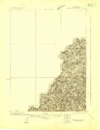
Shasta Valley Sheet No 15, California, USGS topographic map dated 1922.
Includes geographic coordinates (latitude and longitude). This topographic map is suitable for hiking, camping, and exploring, or framing it as a wall map.
Printed on-demand using high resolution imagery, on heavy weight and acid free paper, or alternatively on a variety of synthetic materials.
Topos available on paper, Waterproof, Poly, or Tyvek. Usually shipping rolled, unless combined with other folded maps in one order.
- Product Number: USGS-5657995
- Free digital map download (high-resolution, GeoPDF): Shasta Valley Sheet No 15, California (file size: 7 MB)
- Map Size: please refer to the dimensions of the GeoPDF map above
- Weight (paper map): ca. 55 grams
- Map Type: POD USGS Topographic Map
- Map Series: HTMC
- Map Verison: Historical
- Cell ID: 395886
- Scan ID: 295155
- Survey Year: 1922
- Datum: NAD
- Map Projection: Polyconic
- Advance: Yes
- Map published by United States Geological Survey
- Keywords: Nonstandard Press Run
- Map Language: English
- Scanner Resolution: 600 dpi
- Map Cell Name: Shasta Valley Sheet No 15
- Grid size: 7.5 X 7.5 Minute
- Date on map: 1922
- Map Scale: 1:24000
- Geographical region: California, United States
Neighboring Maps:
All neighboring USGS topo maps are available for sale online at a variety of scales.
Spatial coverage:
Topo map Shasta Valley Sheet No 15, California, covers the geographical area associated the following places:
- Wildcat Gulch - Rocky Gulch - Brush Creek - Long Gulch - Little Bogus Creek - Coyote Peak - Iron Gate Reservoir - Cedar Gulch - Scotch Creek - Iron Gate Dam - Juniper Point Picnic Area - Dutch Creek - Bogus Creek - Sentinel Rocks - Camp Creek - Low Wood School (historical) - Dry Creek - Camp Creek Campground - Wanaka Spring - Salt Creek - Wadsworth Flat - Slide Creek - Liskey - Bullhead Creek - Mirror Cove Picnic Area - Iron Gate Fish Hatchery - Brushy Gulch
- Map Area ID: AREA4241.9-122.5-122.4
- Northwest corner Lat/Long code: USGSNW42-122.5
- Northeast corner Lat/Long code: USGSNE42-122.4
- Southwest corner Lat/Long code: USGSSW41.9-122.5
- Southeast corner Lat/Long code: USGSSE41.9-122.4
- Northern map edge Latitude: 42
- Southern map edge Latitude: 41.9
- Western map edge Longitude: -122.5
- Eastern map edge Longitude: -122.4


