
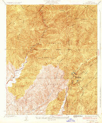
~ Red Mountain CA topo map, 1:24000 scale, 7.5 X 7.5 Minute, Historical, 1936
Red Mountain, California, USGS topographic map dated 1936.
Includes geographic coordinates (latitude and longitude). This topographic map is suitable for hiking, camping, and exploring, or framing it as a wall map.
Printed on-demand using high resolution imagery, on heavy weight and acid free paper, or alternatively on a variety of synthetic materials.
Topos available on paper, Waterproof, Poly, or Tyvek. Usually shipping rolled, unless combined with other folded maps in one order.
- Product Number: USGS-5657877
- Free digital map download (high-resolution, GeoPDF): Red Mountain, California (file size: 12 MB)
- Map Size: please refer to the dimensions of the GeoPDF map above
- Weight (paper map): ca. 55 grams
- Map Type: POD USGS Topographic Map
- Map Series: HTMC
- Map Verison: Historical
- Cell ID: 395917
- Scan ID: 294558
- Woodland Tint: Yes
- Survey Year: 1931
- Datum: NAD
- Map Projection: Polyconic
- Map published by United States Geological Survey
- Map Language: English
- Scanner Resolution: 600 dpi
- Map Cell Name: Red Mountain
- Grid size: 7.5 X 7.5 Minute
- Date on map: 1936
- Map Scale: 1:24000
- Geographical region: California, United States
Neighboring Maps:
All neighboring USGS topo maps are available for sale online at a variety of scales.
Spatial coverage:
Topo map Red Mountain, California, covers the geographical area associated the following places:
- Elizabeth Lake Guard Station - Warm Springs Necktie Trail - Drinkwater Flat - Ruby Spring - San Francisquito Powerhouse Number Two - Drinkwater Canyon - Bee School (historical) - Drinkwater 6-016 Dam - Ruby Clearwater Truck Trail - Newhall Division - United States Forest Service Angeles National Forest Station - San Francisquito Canyon - Dry Gulch - Los Angeles Aqueduct - Tule Canyon - Baal Point Picnic Area - Dry Target Shooting Area - Bitter Canyon - Red Mountain - Necktie Basin - Warm Springs Trail - Elizabeth Lake Canyon - Warm Springs Mountain - Drinkwater Reservoir - Canyon Christian Camp
- Map Area ID: AREA34.634.5-118.6-118.5
- Northwest corner Lat/Long code: USGSNW34.6-118.6
- Northeast corner Lat/Long code: USGSNE34.6-118.5
- Southwest corner Lat/Long code: USGSSW34.5-118.6
- Southeast corner Lat/Long code: USGSSE34.5-118.5
- Northern map edge Latitude: 34.6
- Southern map edge Latitude: 34.5
- Western map edge Longitude: -118.6
- Eastern map edge Longitude: -118.5


