
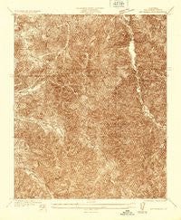
~ Mt Emma CA topo map, 1:24000 scale, 7.5 X 7.5 Minute, Historical, 1935, updated 1935
Mt Emma, California, USGS topographic map dated 1935.
Includes geographic coordinates (latitude and longitude). This topographic map is suitable for hiking, camping, and exploring, or framing it as a wall map.
Printed on-demand using high resolution imagery, on heavy weight and acid free paper, or alternatively on a variety of synthetic materials.
Topos available on paper, Waterproof, Poly, or Tyvek. Usually shipping rolled, unless combined with other folded maps in one order.
- Product Number: USGS-5657779
- Free digital map download (high-resolution, GeoPDF): Mt Emma, California (file size: 14 MB)
- Map Size: please refer to the dimensions of the GeoPDF map above
- Weight (paper map): ca. 55 grams
- Map Type: POD USGS Topographic Map
- Map Series: HTMC
- Map Verison: Historical
- Cell ID: 395958
- Scan ID: 293286
- Imprint Year: 1935
- Survey Year: 1935
- Datum: NAD
- Map Projection: Polyconic
- Advance: Yes
- Map published by United States Geological Survey
- Keywords: Nonstandard Press Run
- Map Language: English
- Scanner Resolution: 600 dpi
- Map Cell Name: Mount Emma
- Grid size: 7.5 X 7.5 Minute
- Date on map: 1935
- Map Scale: 1:24000
- Geographical region: California, United States
Neighboring Maps:
All neighboring USGS topo maps are available for sale online at a variety of scales.
Spatial coverage:
Topo map Mt Emma, California, covers the geographical area associated the following places:
- Campground Number Three - Little Rock-Palmdale Dam - Mount Emma Ridge - Basin Campground - Campground Number Two - Santiago Canyon - Wagonwheel Ranch - Little Rock Station - Kitter Canyon - Desert Marksmen Rifle Range - Little Rock Resort - Mount Emma - Little Rock Creek - Lakeside Campground - Joshua Tree Campground - Little Rock Reservoir - West Fork Bare Mountain Canyon - Cabin Canyon
- Map Area ID: AREA34.534.4-118.1-118
- Northwest corner Lat/Long code: USGSNW34.5-118.1
- Northeast corner Lat/Long code: USGSNE34.5-118
- Southwest corner Lat/Long code: USGSSW34.4-118.1
- Southeast corner Lat/Long code: USGSSE34.4-118
- Northern map edge Latitude: 34.5
- Southern map edge Latitude: 34.4
- Western map edge Longitude: -118.1
- Eastern map edge Longitude: -118


