
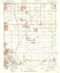
~ Los Alamitos CA topo map, 1:24000 scale, 7.5 X 7.5 Minute, Historical, 1949, updated 1957
Los Alamitos, California, USGS topographic map dated 1949.
Includes geographic coordinates (latitude and longitude). This topographic map is suitable for hiking, camping, and exploring, or framing it as a wall map.
Printed on-demand using high resolution imagery, on heavy weight and acid free paper, or alternatively on a variety of synthetic materials.
Topos available on paper, Waterproof, Poly, or Tyvek. Usually shipping rolled, unless combined with other folded maps in one order.
- Product Number: USGS-5657717
- Free digital map download (high-resolution, GeoPDF): Los Alamitos, California (file size: 9 MB)
- Map Size: please refer to the dimensions of the GeoPDF map above
- Weight (paper map): ca. 55 grams
- Map Type: POD USGS Topographic Map
- Map Series: HTMC
- Map Verison: Historical
- Cell ID: 26616
- Scan ID: 292534
- Imprint Year: 1957
- Woodland Tint: Yes
- Aerial Photo Year: 1947
- Field Check Year: 1949
- Survey Year: 1932
- Datum: NAD27
- Map Projection: Polyconic
- Map published by United States Geological Survey
- Keywords: Overedge
- Map Language: English
- Scanner Resolution: 600 dpi
- Map Cell Name: Los Alamitos
- Grid size: 7.5 X 7.5 Minute
- Date on map: 1949
- Map Scale: 1:24000
- Geographical region: California, United States
Neighboring Maps:
All neighboring USGS topo maps are available for sale online at a variety of scales.
Spatial coverage:
Topo map Los Alamitos, California, covers the geographical area associated the following places:
- Moody - Los Alisos Mobile Home Estates - Leisure World - Los Alamitos - Rossmoor - Naples - Artesia - La Palma - Bingham - Dolley - Halcon - Royal Oak Mobile Home Park - Los Robles Mobile Home Park - Shirley - Cypress - Westminster - Lincoln Center Mobile Home Park - Hawaiian Gardens - Hansen - Barber City - Cerritos
- Map Area ID: AREA33.87533.75-118.125-118
- Northwest corner Lat/Long code: USGSNW33.875-118.125
- Northeast corner Lat/Long code: USGSNE33.875-118
- Southwest corner Lat/Long code: USGSSW33.75-118.125
- Southeast corner Lat/Long code: USGSSE33.75-118
- Northern map edge Latitude: 33.875
- Southern map edge Latitude: 33.75
- Western map edge Longitude: -118.125
- Eastern map edge Longitude: -118


