
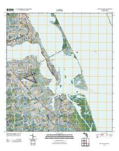
~ Saint Lucie Inlet FL topo map, 1:24000 scale, 7.5 X 7.5 Minute, Historical, 2012
Saint Lucie Inlet, Florida, USGS topographic map dated 2012.
Includes geographic coordinates (latitude and longitude). This topographic map is suitable for hiking, camping, and exploring, or framing it as a wall map.
Printed on-demand using high resolution imagery, on heavy weight and acid free paper, or alternatively on a variety of synthetic materials.
Topos available on paper, Waterproof, Poly, or Tyvek. Usually shipping rolled, unless combined with other folded maps in one order.
- Product Number: USGS-5656847
- Free digital map download (high-resolution, GeoPDF): Saint Lucie Inlet, Florida (file size: 25 MB)
- Map Size: please refer to the dimensions of the GeoPDF map above
- Weight (paper map): ca. 55 grams
- Map Type: POD USGS Topographic Map
- Map Series: US Topo
- Map Verison: Historical
- Cell ID: 39341
- Datum: North American Datum of 1983
- Map Projection: Transverse Mercator
- Map Cell Name: Saint Lucie Inlet
- Grid size: 7.5 X 7.5 Minute
- Date on map: 2012
- Map Scale: 1:24000
- Geographical region: Florida, United States
Neighboring Maps:
All neighboring USGS topo maps are available for sale online at a variety of scales.
Spatial coverage:
Topo map Saint Lucie Inlet, Florida, covers the geographical area associated the following places:
- Port Sewall - Seminole Shores - Fruita - Natalie Estates Mobile Home Park - Port Salerno - Sewall's Point - Golden Gate - Coral Gardens - Skyline Heights - Ocean Breeze Park - Holiday Mobile Home Park - Salerno Trailer Park - Open Gate Trailer Park - Rio - Sunshine Mobile Manor - Snug Harbor - Tropical Acres Mobile Home Park - Pinelake Village Mobile Home Park
- Map Area ID: AREA27.2527.125-80.25-80.125
- Northwest corner Lat/Long code: USGSNW27.25-80.25
- Northeast corner Lat/Long code: USGSNE27.25-80.125
- Southwest corner Lat/Long code: USGSSW27.125-80.25
- Southeast corner Lat/Long code: USGSSE27.125-80.125
- Northern map edge Latitude: 27.25
- Southern map edge Latitude: 27.125
- Western map edge Longitude: -80.25
- Eastern map edge Longitude: -80.125


