
~ Dover FL topo map, 1:24000 scale, 7.5 X 7.5 Minute, Historical, 2012
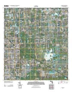
Dover, Florida, USGS topographic map dated 2012.
Includes geographic coordinates (latitude and longitude). This topographic map is suitable for hiking, camping, and exploring, or framing it as a wall map.
Printed on-demand using high resolution imagery, on heavy weight and acid free paper, or alternatively on a variety of synthetic materials.
Topos available on paper, Waterproof, Poly, or Tyvek. Usually shipping rolled, unless combined with other folded maps in one order.
- Product Number: USGS-5655684
- Free digital map download (high-resolution, GeoPDF): Dover, Florida (file size: 23 MB)
- Map Size: please refer to the dimensions of the GeoPDF map above
- Weight (paper map): ca. 55 grams
- Map Type: POD USGS Topographic Map
- Map Series: US Topo
- Map Verison: Historical
- Cell ID: 12691
- Datum: North American Datum of 1983
- Map Projection: Transverse Mercator
- Map Cell Name: Dover
- Grid size: 7.5 X 7.5 Minute
- Date on map: 2012
- Map Scale: 1:24000
- Geographical region: Florida, United States
Neighboring Maps:
All neighboring USGS topo maps are available for sale online at a variety of scales.
Spatial coverage:
Topo map Dover, Florida, covers the geographical area associated the following places:
- Harder Oaks - Hinson Acres - Bent Tree Estates - Valrico Groves - Gillespies Glen - Salem Oaks - C T Lewis Acres - Messick Acres - Bonterra - Delgado - Legends Pass - Stone Hollow - Dover - Dumont - Critter Lane - Peeples Acres - Dover Oaks - Eaglewood Estates - Cinnamon Trace - Canterbury Oaks - Buckhorn Oaks - Eastmonte - Kaylas Cove - Trapnell Ridge - Buckhorn Springs Mobile Villa - Orchid Grove - Turkey Hollow - Ranch Road Groves - Buckhorn Golf Club Estates - Welch Creek Acres - Joannas Reserve - Lucas Manor - Heritage Crest - Sugar Cane Acres - Kings Mill - Austin Oaks - Windcrest Commons - Canter - El Pavo Vista - Innergary Point - Evers Acres - McIntosh Lakes - Popago Estates - East Brandon Heights - Leighton Acres - Wallace Road Acres - Puntkins Patch - Doris Swilley Acres - Leland Estates - Parrish - Interdonato Place - Wheeler Oak - Park Meadow - Lovitis Park - Par Meadows - Country Gate - Valrico Forest - Davis Acres - Sara Anna Estates - Westminster - Country Woods Estates - Springdell Estates - Drakes Place - Buckhorn Trace - Brandon Valrico Hills Estates - Camden Oaks - Dunn - Lehman Acres - Greenhills - West Plant City Farms - Pleasant Grove - Medley Manor - Durant - Turkey Creek Acres - Sydney Crossings - Copper Ridge - Country Breeze Estates - The Paddocks - Miller Woods - Raulerson Estates North - Buckhorn Preserve - Shepherd Plantation - Valrico Heights - Diamond Hill - Raulerson Estates South - Stone Hedge - Jaudon Ranch Estates - Mason Oaks - Ashbrook - Aarons Place - Holloway Creek - Wetherington Oaks - Buckhorn Hills - Allens Cove - Martin - Mulrennan Groves North - Pine Dale Estates - Reynoso - Daniels Acres - Pleasant Grove Acres
- Map Area ID: AREA2827.875-82.25-82.125
- Northwest corner Lat/Long code: USGSNW28-82.25
- Northeast corner Lat/Long code: USGSNE28-82.125
- Southwest corner Lat/Long code: USGSSW27.875-82.25
- Southeast corner Lat/Long code: USGSSE27.875-82.125
- Northern map edge Latitude: 28
- Southern map edge Latitude: 27.875
- Western map edge Longitude: -82.25
- Eastern map edge Longitude: -82.125


