
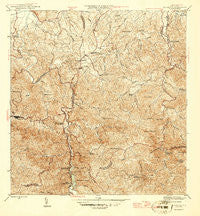
~ Naranjito PR topo map, 1:30000 scale, 7.5 X 7.5 Minute, Historical, 1946
Naranjito, Puerto Rico, USGS topographic map dated 1946.
Includes geographic coordinates (latitude and longitude). This topographic map is suitable for hiking, camping, and exploring, or framing it as a wall map.
Printed on-demand using high resolution imagery, on heavy weight and acid free paper, or alternatively on a variety of synthetic materials.
Topos available on paper, Waterproof, Poly, or Tyvek. Usually shipping rolled, unless combined with other folded maps in one order.
- Product Number: USGS-5655400
- Free digital map download (high-resolution, GeoPDF): Naranjito, Puerto Rico (file size: 13 MB)
- Map Size: please refer to the dimensions of the GeoPDF map above
- Weight (paper map): ca. 55 grams
- Map Type: POD USGS Topographic Map
- Map Series: HTMC
- Map Verison: Historical
- Cell ID: 31333
- Scan ID: 362490
- Datum: Puerto Rico
- Map Projection: Polyconic
- Map published by United States Geological Survey
- Map Language: English
- Scanner Resolution: 600 dpi
- Map Cell Name: Naranjito
- Grid size: 7.5 X 7.5 Minute
- Date on map: 1946
- Map Scale: 1:30000
- Geographical region: Puerto Rico, United States
Neighboring Maps:
All neighboring USGS topo maps are available for sale online at a variety of scales.
Spatial coverage:
Topo map Naranjito, Puerto Rico, covers the geographical area associated the following places:
- El Portón - San Augustin II - Pájaros Comunidad - Las Americas - Bella Vista - Naranjito Zona Urbana - Santa Rosa - Alturas de San Sauci - Valle de Cerro Gordo - Montanez - San Sebastián - Faría - Alegría - Sabana - Lomas Verdes - Santa Juanita - Sunny Hills - Flamingo Garden - Villas de San Augustin - Reparto Zarina - Pájaro Puertorriqueño - Naranjito - Country States - Villa del Olimpio - Irlanda Heights - El Ocho - Bella Vista Height - Versailles - Rexville - Estancias de Cerro Gordo - Santa Rosa Tres - Sector La Tosca - Pamorama - Irlanda - Alturas de Cana - Alturas de San Sauci - Tío - Jardines de Bayamonte - Barrio Nuevo - Van Scoy - Royal Town - San Augustin I - Villa Verde - El Cortijo - Pájaros - Piña - Vista Bella - Pacelas Juan Sanchez - San Sauci - Cana
- Map Area ID: AREA18.37518.25-66.25-66.125
- Northwest corner Lat/Long code: USGSNW18.375-66.25
- Northeast corner Lat/Long code: USGSNE18.375-66.125
- Southwest corner Lat/Long code: USGSSW18.25-66.25
- Southeast corner Lat/Long code: USGSSE18.25-66.125
- Northern map edge Latitude: 18.375
- Southern map edge Latitude: 18.25
- Western map edge Longitude: -66.25
- Eastern map edge Longitude: -66.125


