
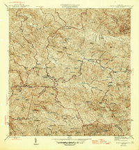
~ Monte Guilarte PR topo map, 1:30000 scale, 7.5 X 7.5 Minute, Historical, 1946
Monte Guilarte, Puerto Rico, USGS topographic map dated 1946.
Includes geographic coordinates (latitude and longitude). This topographic map is suitable for hiking, camping, and exploring, or framing it as a wall map.
Printed on-demand using high resolution imagery, on heavy weight and acid free paper, or alternatively on a variety of synthetic materials.
Topos available on paper, Waterproof, Poly, or Tyvek. Usually shipping rolled, unless combined with other folded maps in one order.
- Product Number: USGS-5655386
- Free digital map download (high-resolution, GeoPDF): Monte Guilarte, Puerto Rico (file size: 14 MB)
- Map Size: please refer to the dimensions of the GeoPDF map above
- Weight (paper map): ca. 55 grams
- Map Type: POD USGS Topographic Map
- Map Series: HTMC
- Map Verison: Historical
- Cell ID: 29910
- Scan ID: 362483
- Visual Version Number: 1
- Datum: Puerto Rico
- Map Projection: Polyconic
- Map published by United States Geological Survey
- Map Language: English
- Scanner Resolution: 600 dpi
- Map Cell Name: Monte Guilarte
- Grid size: 7.5 X 7.5 Minute
- Date on map: 1946
- Map Scale: 1:30000
- Geographical region: Puerto Rico, United States
Neighboring Maps:
All neighboring USGS topo maps are available for sale online at a variety of scales.
Spatial coverage:
Topo map Monte Guilarte, Puerto Rico, covers the geographical area associated the following places:
- Hacienda Leonor - Hacienda La Balear - Hacienda Pietri - Hacienda Buena Vista - Hacienda Arbela - Hacienda Rivera - Hacienda Santa Anita - Villa Pérez - Hacienda La Vega - Hacienda Bianchi - Hacienda Rosario - Hacienda El Fénix - Hacienda Fortuna - Hacienda Asunción - Hacienda Noez - Hacienda Monserrate - Hacienda Américo - Hacienda Vilella - Hacienda María Antonia - Hacienda La Juanita - Hacienda Las Piñas - Hacienda Iberia - Hacienda San Lorenzo - Hacienda Resurrección - Hacienda Olivieri - Hacienda Esperanza - Hacienda Santa Rosa - Hacienda Vaquiñas - Guayabo Dulce - Hacienda San Alberto - Hacienda Ripoll - Hacienda Santa María - Hacienda Santa Clara - Hacienda Concepción - Hacienda Indiera - Hacienda San José - Castañer
- Map Area ID: AREA18.2518.125-66.875-66.75
- Northwest corner Lat/Long code: USGSNW18.25-66.875
- Northeast corner Lat/Long code: USGSNE18.25-66.75
- Southwest corner Lat/Long code: USGSSW18.125-66.875
- Southeast corner Lat/Long code: USGSSE18.125-66.75
- Northern map edge Latitude: 18.25
- Southern map edge Latitude: 18.125
- Western map edge Longitude: -66.875
- Eastern map edge Longitude: -66.75


