
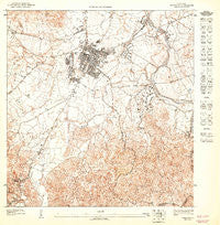
~ Caguas NE PR topo map, 1:10000 scale, 3.75 X 3.75 Minute, Historical, 1947
Caguas NE, Puerto Rico, USGS topographic map dated 1947.
Includes geographic coordinates (latitude and longitude). This topographic map is suitable for hiking, camping, and exploring, or framing it as a wall map.
Printed on-demand using high resolution imagery, on heavy weight and acid free paper, or alternatively on a variety of synthetic materials.
Topos available on paper, Waterproof, Poly, or Tyvek. Usually shipping rolled, unless combined with other folded maps in one order.
- Product Number: USGS-5654060
- Free digital map download (high-resolution, GeoPDF): Caguas NE, Puerto Rico (file size: 18 MB)
- Map Size: please refer to the dimensions of the GeoPDF map above
- Weight (paper map): ca. 55 grams
- Map Type: POD USGS Topographic Map
- Map Series: HTMC
- Map Verison: Historical
- Cell ID: 130339
- Scan ID: 361947
- Survey Year: 1943
- Datum: Unstated
- Map Projection: Polyconic
- Map published by United States Geological Survey
- Map Language: Spanish
- Scanner Resolution: 600 dpi
- Map Cell Name: Caguas NE
- Grid size: 3.75 X 3.75 Minute
- Date on map: 1947
- Map Scale: 1:10000
- Geographical region: Puerto Rico, United States
Neighboring Maps:
All neighboring USGS topo maps are available for sale online at a variety of scales.
Spatial coverage:
Topo map Caguas NE, Puerto Rico, covers the geographical area associated the following places:
- Villa Blanca - San Antonio - Urbanizacion Machin - Villa del Rey - Alturas de Villas del Rey - Villas de Castro - Parcelas de Navarro Comunidad - Boulevardo Tomas de Castro II - Villa Nueva - Villa Caliz - Hacienda Borinquen - Morales - Turabo Heights - Condado Moderno - Residencial La Meseta - Santa Elvira - Villas del Ray 3 - Suarez - Residencial Castellon - El Cinco - Extension El Verde - Santa Juana - Idamaris Gardens - Valle Tolina - Jose Delgado - Parque Las Mercedes - San Carlos - Caguax - El Condado - Notre Dame - Residencial Jose Gautier Benitez - Estancias de Degetau II - Tomás de Castro - Caguas - Villa del Carmen - Villas del Rey 4 - Caguas Norte - Los Prados Comunidad - Bonneville Heights - Estancias de Degetau I - Villa Criollos - Portales Reales - Jardines de Condado Moderno - Santa Cecilia - Los Flamboyanes - Villas del Ray I - Santa Rosa - Parque de Bonneville - Villas de Rio Verde - Caguas Gardens - Alatos de Fuente - José Mercado - Tierra Linda - Brooklyn - Villa Borinquen - Villa Hermosa - Turabo Gardens - Hacienda del Parque - Bonneville - Caguas Zona Urbana - El Verde
- Map Area ID: AREA18.2518.1875-66.0625-66
- Northwest corner Lat/Long code: USGSNW18.25-66.0625
- Northeast corner Lat/Long code: USGSNE18.25-66
- Southwest corner Lat/Long code: USGSSW18.1875-66.0625
- Southeast corner Lat/Long code: USGSSE18.1875-66
- Northern map edge Latitude: 18.25
- Southern map edge Latitude: 18.1875
- Western map edge Longitude: -66.0625
- Eastern map edge Longitude: -66


