
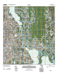
~ Oldsmar FL topo map, 1:24000 scale, 7.5 X 7.5 Minute, Historical, 2012
Oldsmar, Florida, USGS topographic map dated 2012.
Includes geographic coordinates (latitude and longitude). This topographic map is suitable for hiking, camping, and exploring, or framing it as a wall map.
Printed on-demand using high resolution imagery, on heavy weight and acid free paper, or alternatively on a variety of synthetic materials.
Topos available on paper, Waterproof, Poly, or Tyvek. Usually shipping rolled, unless combined with other folded maps in one order.
- Product Number: USGS-5653824
- Free digital map download (high-resolution, GeoPDF): Oldsmar, Florida (file size: 24 MB)
- Map Size: please refer to the dimensions of the GeoPDF map above
- Weight (paper map): ca. 55 grams
- Map Type: POD USGS Topographic Map
- Map Series: US Topo
- Map Verison: Historical
- Cell ID: 33128
- Datum: North American Datum of 1983
- Map Projection: Transverse Mercator
- Map Cell Name: Oldsmar
- Grid size: 7.5 X 7.5 Minute
- Date on map: 2012
- Map Scale: 1:24000
- Geographical region: Florida, United States
Neighboring Maps:
All neighboring USGS topo maps are available for sale online at a variety of scales.
Spatial coverage:
Topo map Oldsmar, Florida, covers the geographical area associated the following places:
- Country Chase - Innfields - Turnberry at the Eagles - Oldsmar - Canterbury North at the Eagles - Prestwick at The Eagles - Royal Troon Village - Reolds Acre - West Hampton - Double Branch Estates - Curlew - Lake Shore Estates - Westchester - River Chase - Windsor Park at the Eagles - Hampton Lakes at Main Street - Saint Andrews at the Eagles - Mecca - Twin Branch Acres - Saltmarsh - Harbor Palms - Nine Eagles - Reolds Farm - Canterbury Heights at the Eagles - Aston Villas - Saint George - Roxana Woods - Point at Mobbly Bay - Westwood Lakes - Canterbury Village - East Lake - Bridgeport
- Map Area ID: AREA28.12528-82.75-82.625
- Northwest corner Lat/Long code: USGSNW28.125-82.75
- Northeast corner Lat/Long code: USGSNE28.125-82.625
- Southwest corner Lat/Long code: USGSSW28-82.75
- Southeast corner Lat/Long code: USGSSE28-82.625
- Northern map edge Latitude: 28.125
- Southern map edge Latitude: 28
- Western map edge Longitude: -82.75
- Eastern map edge Longitude: -82.625


