
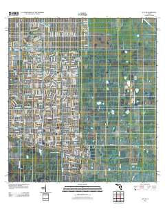
~ Alva SE FL topo map, 1:24000 scale, 7.5 X 7.5 Minute, Historical, 2012
Alva SE, Florida, USGS topographic map dated 2012.
Includes geographic coordinates (latitude and longitude). This topographic map is suitable for hiking, camping, and exploring, or framing it as a wall map.
Printed on-demand using high resolution imagery, on heavy weight and acid free paper, or alternatively on a variety of synthetic materials.
Topos available on paper, Waterproof, Poly, or Tyvek. Usually shipping rolled, unless combined with other folded maps in one order.
- Product Number: USGS-5652572
- Free digital map download (high-resolution, GeoPDF): Alva SE, Florida (file size: 21 MB)
- Map Size: please refer to the dimensions of the GeoPDF map above
- Weight (paper map): ca. 55 grams
- Map Type: POD USGS Topographic Map
- Map Series: US Topo
- Map Verison: Historical
- Cell ID: 790
- Datum: North American Datum of 1983
- Map Projection: Transverse Mercator
- Map Cell Name: Alva SE
- Grid size: 7.5 X 7.5 Minute
- Date on map: 2012
- Map Scale: 1:24000
- Geographical region: Florida, United States
Neighboring Maps:
All neighboring USGS topo maps are available for sale online at a variety of scales.
Spatial coverage:
Topo map Alva SE, Florida, covers the geographical area associated the following places:
- First Baptist Church of Lehigh - Lakeview Golf Club - Faith Lutheran Church - Fussel Slough - WWCL-AM (Lehigh Acres) - Lakewood Country Club - Richmond Avenue Baptist Church of Lehigh - Temple Emanuel - Lehigh Acres Christian Church - Sunshine Elementary School - Lehigh Acres Fire Control and Rescue District Station 105 Headquarters - Landings Yacht Golf and Tennis Club - Corkscrew Lookout Tower
- Map Area ID: AREA26.62526.5-81.625-81.5
- Northwest corner Lat/Long code: USGSNW26.625-81.625
- Northeast corner Lat/Long code: USGSNE26.625-81.5
- Southwest corner Lat/Long code: USGSSW26.5-81.625
- Southeast corner Lat/Long code: USGSSE26.5-81.5
- Northern map edge Latitude: 26.625
- Southern map edge Latitude: 26.5
- Western map edge Longitude: -81.625
- Eastern map edge Longitude: -81.5


