
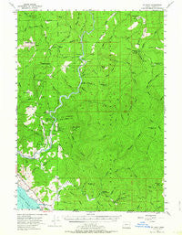
~ Mt Emily OR topo map, 1:62500 scale, 15 X 15 Minute, Historical, 1954, updated 1964
Mt Emily, Oregon, USGS topographic map dated 1954.
Includes geographic coordinates (latitude and longitude). This topographic map is suitable for hiking, camping, and exploring, or framing it as a wall map.
Printed on-demand using high resolution imagery, on heavy weight and acid free paper, or alternatively on a variety of synthetic materials.
Topos available on paper, Waterproof, Poly, or Tyvek. Usually shipping rolled, unless combined with other folded maps in one order.
- Product Number: USGS-5648511
- Free digital map download (high-resolution, GeoPDF): Mt Emily, Oregon (file size: 9 MB)
- Map Size: please refer to the dimensions of the GeoPDF map above
- Weight (paper map): ca. 55 grams
- Map Type: POD USGS Topographic Map
- Map Series: HTMC
- Map Verison: Historical
- Cell ID: 57962
- Scan ID: 282744
- Imprint Year: 1964
- Woodland Tint: Yes
- Aerial Photo Year: 1952
- Field Check Year: 1954
- Datum: NAD27
- Map Projection: Polyconic
- Map published by United States Geological Survey
- Keywords: Overedge
- Map Language: English
- Scanner Resolution: 600 dpi
- Map Cell Name: Mount Emily
- Grid size: 15 X 15 Minute
- Date on map: 1954
- Map Scale: 1:62500
- Geographical region: Oregon, United States
Neighboring Maps:
All neighboring USGS topo maps are available for sale online at a variety of scales.
Spatial coverage:
Topo map Mt Emily, Oregon, covers the geographical area associated the following places:
- Coon Creek - Bridge Creek - Buzzard Roost - Pioneer Cemetery - Camel Rock - Winchuck State Park - Moser Creek - Redwood Bar Boat Launch - Nook Creek - Wilson Prairie - Yank Prairie - Little Redwood Recreation Site - North Fork Chetco River - McVay Rock - Basin Creek - Social Security Bar Boat Launch - Quail Prairie Creek - Carey Creek - Long Ridge Campground (historical) - Elk Creek - Dry Creek - Eagle Creek - Northern Prairie - Gardner Bar - Ram Creek - Pollywog Butte - Bear Ridge - Wheeler Ridge - Panther Creek - Hamilton Creek - First Creek - Mount Emily - Ransom Creek - Long Ridge - Mill Creek - Big Redwood Creek - Looking-Glass Prairie - Swede Heaven - Boar Backbone - Wildcat Creek - Tamba Ranch - Wheeler Creek - Cooley Creek - Robinson Spring - Red Mountain Prairie - Emily Creek Way - McVay Rock State Park - Peavine Ridge - Jordan Creek - Bear Wallow Lookout (historical) - Stump Prairie - Little Emily Creek - East Fork Winchuck River - Miller Bar Boat Launch - Chetco Post Office (historical) - McVay Creek - Harbor Division - Fourth of July Creek - Elk Mountain - Winchuck River - Wheeler Creek Natural Research Area - Elk Creek - Moores Creek - Nook Bar Recreation Site - Gardner Ridge - Redwood Bar Recreation Site - Rainbow Creek - Ludlum House Recreation Site - Dry Creek - Emily Creek - Ludlum Place - Basin Butte - Wilson Creek - Salmon Creek - First Camp Recreation Site - Second Creek - Devils Backbone - Mineral Hill Fork - Packsaddle Lookout - Nell Creek - Packers Cabin Group Camp - Moore Creek - Palmer Butte - Miller Bar Recreation Site - Sankey Creek - Tide Rock - Louise Creek - Bravo Ranch (historical) - Horse Prairie - Kink Creek - Jack Creek - Cashner Butte - Packsaddle Mountain - Nook Bar Boat Launch - Snaketooth Way - Johnson Creek - Grass Lake - Robinson Spring Creek - Panda Ridge - Winchuck Recreation Site
- Map Area ID: AREA42.2542-124.25-124
- Northwest corner Lat/Long code: USGSNW42.25-124.25
- Northeast corner Lat/Long code: USGSNE42.25-124
- Southwest corner Lat/Long code: USGSSW42-124.25
- Southeast corner Lat/Long code: USGSSE42-124
- Northern map edge Latitude: 42.25
- Southern map edge Latitude: 42
- Western map edge Longitude: -124.25
- Eastern map edge Longitude: -124


