
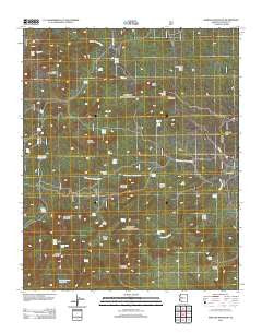
~ Seepage Mountain AZ topo map, 1:24000 scale, 7.5 X 7.5 Minute, Historical, 2012
Seepage Mountain, Arizona, USGS topographic map dated 2012.
Includes geographic coordinates (latitude and longitude). This topographic map is suitable for hiking, camping, and exploring, or framing it as a wall map.
Printed on-demand using high resolution imagery, on heavy weight and acid free paper, or alternatively on a variety of synthetic materials.
Topos available on paper, Waterproof, Poly, or Tyvek. Usually shipping rolled, unless combined with other folded maps in one order.
- Product Number: USGS-5641933
- Free digital map download (high-resolution, GeoPDF): Seepage Mountain, Arizona (file size: 30 MB)
- Map Size: please refer to the dimensions of the GeoPDF map above
- Weight (paper map): ca. 55 grams
- Map Type: POD USGS Topographic Map
- Map Series: US Topo
- Map Verison: Historical
- Cell ID: 40463
- Datum: North American Datum of 1983
- Map Projection: Transverse Mercator
- Map Cell Name: Seepage Mountain
- Grid size: 7.5 X 7.5 Minute
- Date on map: 2012
- Map Scale: 1:24000
- Geographical region: Arizona, United States
Neighboring Maps:
All neighboring USGS topo maps are available for sale online at a variety of scales.
Spatial coverage:
Topo map Seepage Mountain, Arizona, covers the geographical area associated the following places:
- Cottonwood Mountain - Rock Spring - Windy Ridge Spring - Pine Creek Seeps - Denny Mountain - Upper Tailholt Spring - Oak Spring - Wickiup Spring - Parker Spring - Colcord Spring - Hyde Spring - Brushy Mountain - Little Pine Creek Well - Williamson Valley Tank - Seepage Mountain - Whiskey Spring - Johnson Mountain - Tailholt Mesa - Mud Spring - Cement Trough Spring - Cottonwood Wash Spring - Johnson Peak - Prescott National Forest - Sawmill Tank - Brushy Tank - Round Valley Wash - Cabin Spring - Pole Spring - Cross U Ranch - Stringtown Wash - Flat Top - Goat Peak - Dead Steer Basin - Wickiup Canyon - Seepage Tank - Little Quail Spring - Red Mountain Spring - Hyde Creek Seep - Hitt Wash Well - Kckel Spring - Hyde Creek - Humphrey Tank - South Tailholt Tank - Coop Tank - Round Valley Spring - North Tailholt Tank - Section Thirty Spring - Section Twenty-three Tank - Cold Water Tank - West Sedona Elementary School - Tunnel Spring - Wickiup Mesa - Red Mountain - Pine Seep - Wickiup Pit Tank
- Map Area ID: AREA34.87534.75-112.875-112.75
- Northwest corner Lat/Long code: USGSNW34.875-112.875
- Northeast corner Lat/Long code: USGSNE34.875-112.75
- Southwest corner Lat/Long code: USGSSW34.75-112.875
- Southeast corner Lat/Long code: USGSSE34.75-112.75
- Northern map edge Latitude: 34.875
- Southern map edge Latitude: 34.75
- Western map edge Longitude: -112.875
- Eastern map edge Longitude: -112.75


