
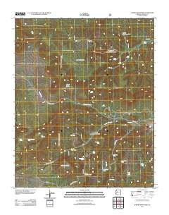
~ Juniper Mountains AZ topo map, 1:24000 scale, 7.5 X 7.5 Minute, Historical, 2012
Juniper Mountains, Arizona, USGS topographic map dated 2012.
Includes geographic coordinates (latitude and longitude). This topographic map is suitable for hiking, camping, and exploring, or framing it as a wall map.
Printed on-demand using high resolution imagery, on heavy weight and acid free paper, or alternatively on a variety of synthetic materials.
Topos available on paper, Waterproof, Poly, or Tyvek. Usually shipping rolled, unless combined with other folded maps in one order.
- Product Number: USGS-5641915
- Free digital map download (high-resolution, GeoPDF): Juniper Mountains, Arizona (file size: 29 MB)
- Map Size: please refer to the dimensions of the GeoPDF map above
- Weight (paper map): ca. 55 grams
- Map Type: POD USGS Topographic Map
- Map Series: US Topo
- Map Verison: Historical
- Cell ID: 22943
- Datum: North American Datum of 1983
- Map Projection: Transverse Mercator
- Map Cell Name: Juniper Mountains
- Grid size: 7.5 X 7.5 Minute
- Date on map: 2012
- Map Scale: 1:24000
- Geographical region: Arizona, United States
Neighboring Maps:
All neighboring USGS topo maps are available for sale online at a variety of scales.
Spatial coverage:
Topo map Juniper Mountains, Arizona, covers the geographical area associated the following places:
- Juniper Trick Tank - Pot Hole Tank - Datry Spring - Turkey Creek - Gobbler Knob - Dairy Spring - Section Thirtythree Tank - Apache Creek Wilderness - Warren Mountain Tank - South Fork Tank - Pine Springs - George Wood Canyon - Turkey Creek Well - Bear Mountain - Seep Tank - Juniper Mesa Wilderness - North Fork Walnut Creek - Two Lion Tank - Little Old Spring - Red Tank - Lee Spring - Table Top Mountain - Pine Flat Tank - Deer Tank - Bear Mountain Tank - Mud Spring - East Turkey Tank - Juniper Mesa - Deer Tank - Hunt Ranch - Apache Creek Seep - Government Spring - Juniper Catchment - South Fork Walnut Creek - Bull Spring - Pine Spring - The Pines Tank - Trick Tank
- Map Area ID: AREA3534.875-113-112.875
- Northwest corner Lat/Long code: USGSNW35-113
- Northeast corner Lat/Long code: USGSNE35-112.875
- Southwest corner Lat/Long code: USGSSW34.875-113
- Southeast corner Lat/Long code: USGSSE34.875-112.875
- Northern map edge Latitude: 35
- Southern map edge Latitude: 34.875
- Western map edge Longitude: -113
- Eastern map edge Longitude: -112.875


