
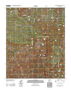
~ Sheridan Mountain AZ topo map, 1:24000 scale, 7.5 X 7.5 Minute, Historical, 2012
Sheridan Mountain, Arizona, USGS topographic map dated 2012.
Includes geographic coordinates (latitude and longitude). This topographic map is suitable for hiking, camping, and exploring, or framing it as a wall map.
Printed on-demand using high resolution imagery, on heavy weight and acid free paper, or alternatively on a variety of synthetic materials.
Topos available on paper, Waterproof, Poly, or Tyvek. Usually shipping rolled, unless combined with other folded maps in one order.
- Product Number: USGS-5641712
- Free digital map download (high-resolution, GeoPDF): Sheridan Mountain, Arizona (file size: 26 MB)
- Map Size: please refer to the dimensions of the GeoPDF map above
- Weight (paper map): ca. 55 grams
- Map Type: POD USGS Topographic Map
- Map Series: US Topo
- Map Verison: Historical
- Cell ID: 71590
- Datum: North American Datum of 1983
- Map Projection: Transverse Mercator
- Map Cell Name: Sheridan Mountain
- Grid size: 7.5 X 7.5 Minute
- Date on map: 2012
- Map Scale: 1:24000
- Geographical region: Arizona, United States
Neighboring Maps:
All neighboring USGS topo maps are available for sale online at a variety of scales.
Spatial coverage:
Topo map Sheridan Mountain, Arizona, covers the geographical area associated the following places:
- Dry Creek Spring - Alkaline Tank - Yolo Trick Tank - Brockmonte Canyon - Moonshine Canyon - Moonshine Spring Number Two - BT Butte - Cottonwood Wash - Boundary Spring - Pine Canyon - Smith Canyon - South Mesa - Jackass Spring - Laurel Spring - Pine Flat Tank - Cedar Mesa - Pine Creek Spring - Seep Spring - Cottonwood Well - Sheridan Lake - Corral Tank - Boulder Tank - Granite Spring - Bull Spring - Section Twenty Nine Tank - Loco Pool Spring - Moonshine Springs - Alkaline Spring - Alligator Spring - Cottonwood Cabin - Sheridan Mountain - Orejano Basin - Bull Tank - Dry Creek - Burro Spring - Barney Well - Blue Dam - Poplar Spring - Moonshine Spring Number Three - Granite Spring - Clay Seep Spring - Blue Tank - Metote Pit Tank - Castle Rock - Corral Spring Tank - South Mesa Tank - Conger Spring
- Map Area ID: AREA34.7534.625-113-112.875
- Northwest corner Lat/Long code: USGSNW34.75-113
- Northeast corner Lat/Long code: USGSNE34.75-112.875
- Southwest corner Lat/Long code: USGSSW34.625-113
- Southeast corner Lat/Long code: USGSSE34.625-112.875
- Northern map edge Latitude: 34.75
- Southern map edge Latitude: 34.625
- Western map edge Longitude: -113
- Eastern map edge Longitude: -112.875


