
~ Horner Mountain AZ topo map, 1:24000 scale, 7.5 X 7.5 Minute, Historical, 2012
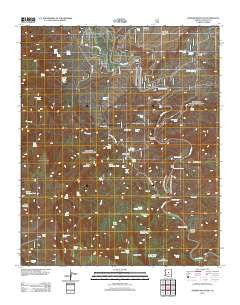
Horner Mountain, Arizona, USGS topographic map dated 2012.
Includes geographic coordinates (latitude and longitude). This topographic map is suitable for hiking, camping, and exploring, or framing it as a wall map.
Printed on-demand using high resolution imagery, on heavy weight and acid free paper, or alternatively on a variety of synthetic materials.
Topos available on paper, Waterproof, Poly, or Tyvek. Usually shipping rolled, unless combined with other folded maps in one order.
- Product Number: USGS-5641168
- Free digital map download (high-resolution, GeoPDF): Horner Mountain, Arizona (file size: 25 MB)
- Map Size: please refer to the dimensions of the GeoPDF map above
- Weight (paper map): ca. 55 grams
- Map Type: POD USGS Topographic Map
- Map Series: US Topo
- Map Verison: Historical
- Cell ID: 70412
- Datum: North American Datum of 1983
- Map Projection: Transverse Mercator
- Map Cell Name: Horner Mountain
- Grid size: 7.5 X 7.5 Minute
- Date on map: 2012
- Map Scale: 1:24000
- Geographical region: Arizona, United States
Neighboring Maps:
All neighboring USGS topo maps are available for sale online at a variety of scales.
Spatial coverage:
Topo map Horner Mountain, Arizona, covers the geographical area associated the following places:
- Monkey Tank - Mesa Tank - Laddens Tank - Bootleg Tank - Chalk Tank - Bear Spring - Red Basin Spring - Squaw Peak Mine - Beasley Flat - Bushman Rapid - Horner Mountain Tank - North Mine Spring - Ox Bow Trail Number One Hundred Sixty Three - Cottonwood Creek - Bull Run Rapid - Punk Rock - Towel Creek - Amerone Spring Number One - Dripping Spring - Turkey Gobbler Rapid - Lower Mine Spring - The Falls - Rodeo Flat Tank - Bear Grass Tank Number Two - Brown Springs - Billy Tank - Horner Mountain - Brown Springs Ranch - Amerone Spring Number Two - Walnut Spring - Oxbow Tank - Mesquite Spring - Beasley Flat Recreation Site - Ladder Tank - Table Mountain Tank - Cedar Bench - Rodeo Flat - Pre-Falls Rapid - Cottonwood Basin - Lithograph Spring - Boulder Tank - Cold Water Trail - Off-the-Wall Rapid - Table Mountain Spring - Gospel Hollow - Cedar Bench Wilderness - White Flash Rapid - Esperanza Spring - Red Bluff Spring - Goat Camp Spring - Sycamore Canyon - Road Tank - Bull Run Creek - Lower Cedar Bench Tank - Sycamore Tank - Mud Spring - Table Mountain - Cold Water Trail Number Twenty Seven - Government Spring - Bear Grass Tank - Lower Cedar Bench Corral - Cedar Spring - Mine Spring - Jims Tank - Verde Tank - Gap Creek - Chasm Creek - Cottonwood Spring - Rodeo Flat Spring - Wingfield Mesa - Chasm Corral - Red Blow Spring - Mesquite Spring - South Pasture Tank - Cold Water Creek - Cedar Bench Tank
- Map Area ID: AREA34.534.375-111.875-111.75
- Northwest corner Lat/Long code: USGSNW34.5-111.875
- Northeast corner Lat/Long code: USGSNE34.5-111.75
- Southwest corner Lat/Long code: USGSSW34.375-111.875
- Southeast corner Lat/Long code: USGSSE34.375-111.75
- Northern map edge Latitude: 34.5
- Southern map edge Latitude: 34.375
- Western map edge Longitude: -111.875
- Eastern map edge Longitude: -111.75


