
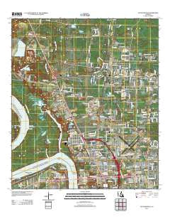
~ Scotlandville LA topo map, 1:24000 scale, 7.5 X 7.5 Minute, Historical, 2012
Scotlandville, Louisiana, USGS topographic map dated 2012.
Includes geographic coordinates (latitude and longitude). This topographic map is suitable for hiking, camping, and exploring, or framing it as a wall map.
Printed on-demand using high resolution imagery, on heavy weight and acid free paper, or alternatively on a variety of synthetic materials.
Topos available on paper, Waterproof, Poly, or Tyvek. Usually shipping rolled, unless combined with other folded maps in one order.
- Product Number: USGS-5640340
- Free digital map download (high-resolution, GeoPDF): Scotlandville, Louisiana (file size: 21 MB)
- Map Size: please refer to the dimensions of the GeoPDF map above
- Weight (paper map): ca. 55 grams
- Map Type: POD USGS Topographic Map
- Map Series: US Topo
- Map Verison: Historical
- Cell ID: 71541
- Datum: North American Datum of 1983
- Map Projection: Transverse Mercator
- Map Cell Name: Scotlandville
- Grid size: 7.5 X 7.5 Minute
- Date on map: 2012
- Map Scale: 1:24000
- Geographical region: Louisiana, United States
Neighboring Maps:
All neighboring USGS topo maps are available for sale online at a variety of scales.
Spatial coverage:
Topo map Scotlandville, Louisiana, covers the geographical area associated the following places:
- Sharon Hills - Timberlane - Jordan Terrace - University Place - McHugh - Mengel Landing - Howell - North Maryland - Baker Estates - Bakerfield - Park Manor - Feliciana - Tristian Village - Moreco - Park Vista - Bolwood Acres - Holiday Acres - Maryland Heights - Fortune - Baker - Loudon - Oak Glen Terrace Mobile Home Park - Ellen Place - McClure Place - Dude's Trailer Park - Crestworth - Buffwood - Airline Terrace - Wyatt Subdivision - Kingston Estates - Saint James Mobile Home Community - Maryland - Parkridge - Glen Oaks - Brentwood Place - White Hills - North Baker Park - Engleswood - Harding Terrace - Scotlandville - Woodaire - Mulatto Bend Landing - Tolbert Place - Gibbens Place - Golden Ridge - Beechwood - Alsen Heights - Howell Community Farms - Lincoln Heights - Harding Heights - Baker Hills - Zion City - Monte Sano Trailer Park - Crestview Village Mobile Home Park - Kings Estates - Scotland - Granberrys Mobile Home Park - Liberty Farms - Jenkins Pryce Place - Highland Farms - Little Lake Estates Mobile Home Park - Southern Heights - Monterey - Irene - Cypress Heights - Alsen - Bethany Cooperative Community - Belmont Landing - Elm Grove Garden - Parkwood Terrace - Saint Pius Place - Cedar Glen - Petite Place - Rolling Acres - Cunnard Place - Azalea Gardens Mobile Home and Recreational Vehicle Park - Brownsfield
- Map Area ID: AREA30.62530.5-91.25-91.125
- Northwest corner Lat/Long code: USGSNW30.625-91.25
- Northeast corner Lat/Long code: USGSNE30.625-91.125
- Southwest corner Lat/Long code: USGSSW30.5-91.25
- Southeast corner Lat/Long code: USGSSE30.5-91.125
- Northern map edge Latitude: 30.625
- Southern map edge Latitude: 30.5
- Western map edge Longitude: -91.25
- Eastern map edge Longitude: -91.125


