
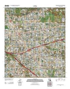
~ Baton Rouge East LA topo map, 1:24000 scale, 7.5 X 7.5 Minute, Historical, 2012
Baton Rouge East, Louisiana, USGS topographic map dated 2012.
Includes geographic coordinates (latitude and longitude). This topographic map is suitable for hiking, camping, and exploring, or framing it as a wall map.
Printed on-demand using high resolution imagery, on heavy weight and acid free paper, or alternatively on a variety of synthetic materials.
Topos available on paper, Waterproof, Poly, or Tyvek. Usually shipping rolled, unless combined with other folded maps in one order.
- Product Number: USGS-5640298
- Free digital map download (high-resolution, GeoPDF): Baton Rouge East, Louisiana (file size: 23 MB)
- Map Size: please refer to the dimensions of the GeoPDF map above
- Weight (paper map): ca. 55 grams
- Map Type: POD USGS Topographic Map
- Map Series: US Topo
- Map Verison: Historical
- Cell ID: 2642
- Datum: North American Datum of 1983
- Map Projection: Transverse Mercator
- Map Cell Name: Baton Rouge East
- Grid size: 7.5 X 7.5 Minute
- Date on map: 2012
- Map Scale: 1:24000
- Geographical region: Louisiana, United States
Neighboring Maps:
All neighboring USGS topo maps are available for sale online at a variety of scales.
Spatial coverage:
Topo map Baton Rouge East, Louisiana, covers the geographical area associated the following places:
- Keaty Place - Acadiana - Shamrock Plaza - Independence Place - Hillside - Partridge Lane Heights - Monticello - Parkview East - Laurel Lea - Magellan Place - Palm Hills - Broadmoor Forest - Courtland Place - Sarasota Place - Staring Acres - Oak Forest - Land O'Lakes - Shenandoah - Riffel Place - Greenway Place - Florida Plaza - Mayfair Park North - The Woodlands - Wellington - Sherwood Oaks South - The Hill - Oak Park - Woodlawn Acres - Normandy Acres - Lakeview Estates - Broadmoor Estates - Oak Valley - Inniswold - O'Neal Place - Pecue Mobile Home Park - Big Oaks Mobile Home Park - Wickland Terrace - Fairmont - Briar Place - Shenandoah Square - Sherwood Forest Mobile Home Park - Village Cote - Goodwood Homesites - Castlewood - Victoria Farm - Night Recreational Vehicle Park - Perkins Place - Sherwood Forest - Jefferson Terrace - Windsor Place - Windfall - South Broadmoor - Videt Place - Broadmoor Plaza - North Red Oaks - Kildare - Pioneer Park - Oakwood Forest - Nesser - Madeline Court - Eastgate - Sherwood Manor - Goodwood Estates - Del Rey Plaza - Essen Plaza - Oakcrest - Wimbledon Estates - Kings Hill - Rushmore - Randolph Heights - Red Oak - Jefferson Shadows - Sherwood Meadow - Howell Park - Wedgewood - Woodshire Village - Airline Acres - Magnolia Woods - Old Jefferson - River Oaks - Torrey Pines Mobile Home Park - Shadowbrook - Parkland Terrace - West River Oaks - Villa Del Rey Park - Tara - Morning Glen - Parkview Oaks - Lynwood Village - Sherwood Forest Estates - Silverside Heights Garden - Avalon - Oak Hill - The Hideaway - Broadmoor Mobile Home Park - Westminster - Plaza 12 Garden Homes - Woodcrest - Fox Run - Oxford Place
- Map Area ID: AREA30.530.375-91.125-91
- Northwest corner Lat/Long code: USGSNW30.5-91.125
- Northeast corner Lat/Long code: USGSNE30.5-91
- Southwest corner Lat/Long code: USGSSW30.375-91.125
- Southeast corner Lat/Long code: USGSSE30.375-91
- Northern map edge Latitude: 30.5
- Southern map edge Latitude: 30.375
- Western map edge Longitude: -91.125
- Eastern map edge Longitude: -91


