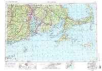
~ Providence RI topo map, 1:250000 scale, 1 X 2 Degree, Historical, 1947, updated 1988
Providence, Rhode Island, USGS topographic map dated 1947.
Includes geographic coordinates (latitude and longitude). This topographic map is suitable for hiking, camping, and exploring, or framing it as a wall map.
Printed on-demand using high resolution imagery, on heavy weight and acid free paper, or alternatively on a variety of synthetic materials.
Topos available on paper, Waterproof, Poly, or Tyvek. Usually shipping rolled, unless combined with other folded maps in one order.
- Product Number: USGS-5638365
- Free digital map download (high-resolution, GeoPDF): Providence, Rhode Island (file size: 25 MB)
- Map Size: please refer to the dimensions of the GeoPDF map above
- Weight (paper map): ca. 55 grams
- Map Type: POD USGS Topographic Map
- Map Series: HTMC
- Map Verison: Historical
- Cell ID: 68975
- Scan ID: 353542
- Imprint Year: 1988
- Woodland Tint: Yes
- Aerial Photo Year: 1943
- Edit Year: 1969
- Datum: Unstated
- Map Projection: Transverse Mercator
- Map published by: Military, Other
- Map Language: English
- Scanner Resolution: 600 dpi
- Map Cell Name: Providence
- Grid size: 1 X 2 Degree
- Date on map: 1947
- Map Scale: 1:250000
- Geographical region: Rhode Island, United States
Neighboring Maps:
All neighboring USGS topo maps are available for sale online at a variety of scales.
Spatial coverage:
Topo map Providence, Rhode Island, covers the geographical area associated the following places:
- Quaise - Sagamore - Knollmere - Black Plain - Barberville - Edgewood - Pomfret Landing - Shimmo - Cumberland Hill - Woodlawn - Six Corners - East Falmouth - Seaweed Beach - Plympton - Richmond (historical) - Harbor Beach - Popponesset Island - North Dighton - Cumberland Mills - Wescott Beach - Foxes Hill - Slocum - Tahanto Beach - Swansea - Middleboro - Portsmouth Park - Sowams (historical) - Mapleville - Apponagansett - Orleans - Kingston - Cataumet - First Encounter Beach - Sesachacha - Manomet Bluffs - Shore Acres - Camp Norse - Codfish Park - Valley Falls - Rocky Brook - New Bedford - Camp Titicut - South Attleboro - Shawomet - Warren - Cahoon Hollow - East Natick - East Sandwich - Patuisset - Nooseneck - West Chop - West Harwich - Pine Hill - Saylesville - Liberty - North Rochester - Oakland Beach - Weir Village - Westport Point - Beachdale - Point Judith - Oneco - Cole Mill - Tuckertown Four Corners - Bridgetown - Macombers Corner - Grand Vue - South Orleans - Almyville - Edgartown - West Brewster - Westerly - Hatchville - Flint Village - Scorton Shores - Bridgewater - Clarks Village - Bayside Beach - Masons Corner - Judson - Halifax Mobile Home Estates - Middle Pasture (historical) - North Westport - Carpenters Corner - Little Compton - Dyerville - Glen Rock - Maushop Village - Clyde - Wades Corner - Greystone - Spencers Corner - Weeset - Smith Mills - Pine Hill Acres - Quissett - Hyannis Port - Hillsgrove - Britanniaville - Cow Yard
- Map Area ID: AREA4241-72-69.8833333
- Northwest corner Lat/Long code: USGSNW42-72
- Northeast corner Lat/Long code: USGSNE42-69.8833333
- Southwest corner Lat/Long code: USGSSW41-72
- Southeast corner Lat/Long code: USGSSE41-69.8833333
- Northern map edge Latitude: 42
- Southern map edge Latitude: 41
- Western map edge Longitude: -72
- Eastern map edge Longitude: -69.8833333

