
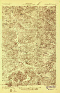
~ Musquacook Lakes ME topo map, 1:48000 scale, 15 X 15 Minute, Historical, 1932
Musquacook Lakes, Maine, USGS topographic map dated 1932.
Includes geographic coordinates (latitude and longitude). This topographic map is suitable for hiking, camping, and exploring, or framing it as a wall map.
Printed on-demand using high resolution imagery, on heavy weight and acid free paper, or alternatively on a variety of synthetic materials.
Topos available on paper, Waterproof, Poly, or Tyvek. Usually shipping rolled, unless combined with other folded maps in one order.
- Product Number: USGS-5638021
- Free digital map download (high-resolution, GeoPDF): Musquacook Lakes, Maine (file size: 10 MB)
- Map Size: please refer to the dimensions of the GeoPDF map above
- Weight (paper map): ca. 55 grams
- Map Type: POD USGS Topographic Map
- Map Series: HTMC
- Map Verison: Historical
- Cell ID: 58213
- Scan ID: 807578
- Survey Year: 1932
- Datum: NAD
- Map Projection: Polyconic
- Advance: Yes
- Map published by United States Geological Survey
- Keywords: Overedge; Nonstandard Press Run
- Map Language: English
- Scanner Resolution: 508 dpi
- Map Cell Name: Musquacook Lakes
- Grid size: 15 X 15 Minute
- Date on map: 1932
- Map Scale: 1:48000
- Geographical region: Maine, United States
Neighboring Maps:
All neighboring USGS topo maps are available for sale online at a variety of scales.
Spatial coverage:
Topo map Musquacook Lakes, Maine, covers the geographical area associated the following places:
- Halfway Brook - Long Pond - Fourth Musquacook Lake - Horse Race Rapids - Little Musquacook Stream - Campbell Brook - Lost Pond - Hudson Mountain - First Musquacook Lake - Mule Brook Mountains - Peaked Mountain Pond - Upper Elbow Pond - Robbins Brook Pond - Clear Lake Mountain - Butlers Camp - Hesse Brook - Grey Brook - Squirrel Pocket - T10 R11 WELS - Fifth Musquacook Lake - Searway Brook - Porters Spring - Twin Pond - Conner Brook - Bog Brook - Robbins Brook - Lower Hudson Pond - Elbow Mountain - Little Pleasant Pond - Harrow Lake - Eyelet Pond - T11 R11 WELS - T12 R11 WELS - T10 R10 WELS - Mountain Pond - Upper Island Pond - McCluskey Brook - Clear Lake - Middle Elbow Pond - Third Musquacook Lake - Squirrel Brook - Squirrel Pond - T11 R10 WELS - Lower Horse Race Rapids - Beaver Brook - Lower Elbow Pond - Second Musquacook Lake - Shepherd Brook Mountain - Rocky Brook Mountains - Upper Hudson Pond - Upper McNally Pond - T12 R10 WELS - Little Harrow Lake
- Map Area ID: AREA46.7546.5-69.25-69
- Northwest corner Lat/Long code: USGSNW46.75-69.25
- Northeast corner Lat/Long code: USGSNE46.75-69
- Southwest corner Lat/Long code: USGSSW46.5-69.25
- Southeast corner Lat/Long code: USGSSE46.5-69
- Northern map edge Latitude: 46.75
- Southern map edge Latitude: 46.5
- Western map edge Longitude: -69.25
- Eastern map edge Longitude: -69


