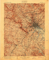
~ Patapsco MD topo map, 1:125000 scale, 30 X 30 Minute, Historical, 1908
Patapsco, Maryland, USGS topographic map dated 1908.
Includes geographic coordinates (latitude and longitude). This topographic map is suitable for hiking, camping, and exploring, or framing it as a wall map.
Printed on-demand using high resolution imagery, on heavy weight and acid free paper, or alternatively on a variety of synthetic materials.
Topos available on paper, Waterproof, Poly, or Tyvek. Usually shipping rolled, unless combined with other folded maps in one order.
- Product Number: USGS-5637873
- Free digital map download (high-resolution, GeoPDF): Patapsco, Maryland (file size: 13 MB)
- Map Size: please refer to the dimensions of the GeoPDF map above
- Weight (paper map): ca. 55 grams
- Map Type: POD USGS Topographic Map
- Map Series: HTMC
- Map Verison: Historical
- Cell ID: 395854
- Scan ID: 257733
- Survey Year: 1906
- Datum: Unstated
- Map Projection: Unstated
- Map published by United States Geological Survey
- Map Language: English
- Scanner Resolution: 600 dpi
- Map Cell Name: Patapsco
- Grid size: 30 X 30 Minute
- Date on map: 1908
- Map Scale: 1:125000
- Geographical region: Maryland, United States
Neighboring Maps:
All neighboring USGS topo maps are available for sale online at a variety of scales.
Spatial coverage:
Topo map Patapsco, Maryland, covers the geographical area associated the following places:
- Riverview (historical) - Salopha - Chestnut Hill Estates - Mays Chapel Village - Crestwood - Fairland Acres - Arbutus - Locust Ridge - Patapsco - Riverside Estates - Cylburn (historical) - Glen Hollow - West Laurel - Freedom Forest - Cromwell Woods - Featherbed - Maryland City - Holly Knoll Estates - Lewiston - Chesterfield - Havenwood - Grays Level - Blackburn Village - Long Meadow West - Armistead Gardens - Danza Village - Ivy Hill - Cherry Corner - Dundalk Mobile Home Court - Dembeigh Hill - Cedarcroft - Coventry - Laurel - Fullerton - Apple Ridge - Eudowood - Harford Hills - Linden Chapel Woods - Jocelyn Acres - Hawthorn North - The Hemlocks - Patuxent Hills - Woodward - Bentwoods - Eleven Cedars - Epping Forest Manor - Fallswood - Quail Ridge - Allyson Gardens - Devonshire Forest - Cockeysville - Milestone Manor - Glen Burnie Heights - North Wind - Bendale - Steward Manor - Bonnie Ridge - Spencer Gardens - Maplewood - Woodberry - Pine Bluff - Wellington Estates - Country Place - Woods Edge - Huntington - Charlestown - Springbrook Manor - Town and Country West - Olde Mill Estates - Village Square - Summit Chase - Woodglen Farms - Lynn Acres - Beauty Beach - Knollwood - McDonogh Park - Chapelgate - Watson Place - Brandy Farms - Timber Grove - Chateau Ridge - Anton Woods - Oak Hollow - Allenville - Aurora Hills - Brampton Hills - Mount Winans - Ivory - Greentop Manor - Oak Crest - Greenbriar - Fair Brook - Elioak - Norwich Acres - Harwood Park - Stonewood - Robin Hood Hill - Presidential Park - Anneslie - Jonestown
- Map Area ID: AREA39.539-77-76.5
- Northwest corner Lat/Long code: USGSNW39.5-77
- Northeast corner Lat/Long code: USGSNE39.5-76.5
- Southwest corner Lat/Long code: USGSSW39-77
- Southeast corner Lat/Long code: USGSSE39-76.5
- Northern map edge Latitude: 39.5
- Southern map edge Latitude: 39
- Western map edge Longitude: -77
- Eastern map edge Longitude: -76.5


