
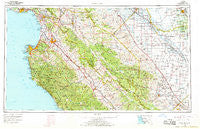
~ Santa Cruz CA topo map, 1:250000 scale, 1 X 2 Degree, Historical, 1965, updated 1968
Santa Cruz, California, USGS topographic map dated 1965.
Includes geographic coordinates (latitude and longitude). This topographic map is suitable for hiking, camping, and exploring, or framing it as a wall map.
Printed on-demand using high resolution imagery, on heavy weight and acid free paper, or alternatively on a variety of synthetic materials.
Topos available on paper, Waterproof, Poly, or Tyvek. Usually shipping rolled, unless combined with other folded maps in one order.
- Product Number: USGS-5637671
- Free digital map download (high-resolution, GeoPDF): Santa Cruz, California (file size: 22 MB)
- Map Size: please refer to the dimensions of the GeoPDF map above
- Weight (paper map): ca. 55 grams
- Map Type: POD USGS Topographic Map
- Map Series: HTMC
- Map Verison: Historical
- Cell ID: 74982
- Scan ID: 302146
- Imprint Year: 1968
- Woodland Tint: Yes
- Aerial Photo Year: 1960
- Field Check Year: 1965
- Datum: NAD27
- Map Projection: Universal Transverse Mercator
- Map published by United States Geological Survey
- Map Language: English
- Scanner Resolution: 600 dpi
- Map Cell Name: Monterey
- Grid size: 1 X 2 Degree
- Date on map: 1965
- Map Scale: 1:250000
- Geographical region: California, United States
Neighboring Maps:
All neighboring USGS topo maps are available for sale online at a variety of scales.
Spatial coverage:
Topo map Santa Cruz, California, covers the geographical area associated the following places:
- Ocean Breeze Mobile Home Park - Duri (historical) - River Oaks - Monterey - Coburn - Port Watsonvile - Spreckels - Tradewinds Mobile Home Park - Greenfield - Opal Cliff Park Mobile Home Park - Tassajara Hot Springs - Country Villa Estates Mobile Home Park - Twin Lakes - Harlem - Bonita - Old Gilroy - Cabrillo Mobile Home Park - Helm - Soquel - Cooper - Oro Loma - Welby - Huron - Del Rey Oaks - Corralitos - Carmel-by-the-Sea - Rugg (historical) - East Garrison - Salinas - Creekside - Watsonville - Penvir - San Juan Bautista - Sargent - Portola Heights Mobile Home Park - Moss - Five Points - Capitola - Santa Cruz - Carmel Valley - Elkhorn - King City - Dean - Mission Oaks Mobile Home Community - Nuga (historical) - Paicines - Three Rocks - Biola - Pinnacles - Castle Mobile Estates - Ambler Park - Interlaken - Monte Toyon - Carmel Valley Village - Betabel (historical) - Majors - Bell Harbor Mobile Home Park - Rio Plaza Mobile Home Park - Hydril - Gordola - Cannery Row - Ridgemark - Aromas - Madera - San Felipe - Carnadero - Tony Ziro Mobile Living Mobile Home Park - Snug Harbor Mobile Home Park - Turk - Colache Town - Docas (historical) - Benito - Mendota - Dos Palos - Gabilan Acres - Orchard Lane Mobile Home Park - Shangri La Estates - Elsa - Kerman - Pacific Grove - Alimur Park Mobile Home Park - Del Monte Heights - Seacliff - Hollister - Rob Roy Junction - Baronet Estates - Slates Hot Springs - Loma Vista Mobile Home Park - Logan - Allegro Heights - Tranquillity - Fresno City (historical) - Hamburg Farms - Corporal - Nashua - Corral de Tierra - New Brighton (historical) - Sycamore Flat - Natividad - Murray
- Map Area ID: AREA3736-122.2-120
- Northwest corner Lat/Long code: USGSNW37-122.2
- Northeast corner Lat/Long code: USGSNE37-120
- Southwest corner Lat/Long code: USGSSW36-122.2
- Southeast corner Lat/Long code: USGSSE36-120
- Northern map edge Latitude: 37
- Southern map edge Latitude: 36
- Western map edge Longitude: -122.2
- Eastern map edge Longitude: -120


