
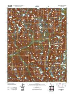
~ Mount Abbot CA topo map, 1:24000 scale, 7.5 X 7.5 Minute, Historical, 2012
Mount Abbot, California, USGS topographic map dated 2012.
Includes geographic coordinates (latitude and longitude). This topographic map is suitable for hiking, camping, and exploring, or framing it as a wall map.
Printed on-demand using high resolution imagery, on heavy weight and acid free paper, or alternatively on a variety of synthetic materials.
Topos available on paper, Waterproof, Poly, or Tyvek. Usually shipping rolled, unless combined with other folded maps in one order.
- Product Number: USGS-5637097
- Free digital map download (high-resolution, GeoPDF): Mount Abbot, California (file size: 23 MB)
- Map Size: please refer to the dimensions of the GeoPDF map above
- Weight (paper map): ca. 55 grams
- Map Type: POD USGS Topographic Map
- Map Series: US Topo
- Map Verison: Historical
- Cell ID: 30440
- Datum: North American Datum of 1983
- Map Projection: Transverse Mercator
- Map Cell Name: Mount Abbot
- Grid size: 7.5 X 7.5 Minute
- Date on map: 2012
- Map Scale: 1:24000
- Geographical region: California, United States
Neighboring Maps:
All neighboring USGS topo maps are available for sale online at a variety of scales.
Spatial coverage:
Topo map Mount Abbot, California, covers the geographical area associated the following places:
- Lower Mills Creek Lake - Gabbot Pass - Ruby Lake - Pioneer Basin Lakes - Mills Creek - Laurel Creek - Mills Lake - Neelle Lake - Marsh Lake - Upper Mills Creek Lake - Mount Huntington - Hopkins Pass - Third Recess Lake - Laurel Lake - Mist Lake - Fourth Recess Lake - Fourth Recess - Mount Stanford - Mono Pass - Ross Finch Lake - Second Recess - Mount Mills - Stanford Lake - Mount Starr - Fish Camp - Heart Lake - Recess Peak - Grinnell Lake - Lower Hopkins Lake - Snow Lakes - Gem Lakes - Summit Lake - Mount Dade - Treasure Lakes - Red and White Mountain - Golden Lake - Frog Lake - Big McGee Lake - Chickenfoot Lake - Hilton Creek Lakes - Trail Lakes - Golden Lake - Box Lake - Morgan Pass - Pioneer Basin - Mono Rock - Hopkins Creek - Third Recess - Upper Hopkins Lakes - Little Grinnell Lake - Long Lake - Little McGee Lake - Red and White Lake - Mount Gabb - First Recess Lakes - Mack Lake - Mount Hopkins - Steelhead Lake - Crocker Lake - First Recess - Mount Crocker - Dade Lake - Little Lakes - Golden Creek - Mount Abbot
- Map Area ID: AREA37.537.375-118.875-118.75
- Northwest corner Lat/Long code: USGSNW37.5-118.875
- Northeast corner Lat/Long code: USGSNE37.5-118.75
- Southwest corner Lat/Long code: USGSSW37.375-118.875
- Southeast corner Lat/Long code: USGSSE37.375-118.75
- Northern map edge Latitude: 37.5
- Southern map edge Latitude: 37.375
- Western map edge Longitude: -118.875
- Eastern map edge Longitude: -118.75


