
~ Alamo Mountain CA topo map, 1:24000 scale, 7.5 X 7.5 Minute, Historical, 2012
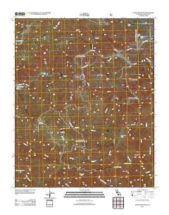
Alamo Mountain, California, USGS topographic map dated 2012.
Includes geographic coordinates (latitude and longitude). This topographic map is suitable for hiking, camping, and exploring, or framing it as a wall map.
Printed on-demand using high resolution imagery, on heavy weight and acid free paper, or alternatively on a variety of synthetic materials.
Topos available on paper, Waterproof, Poly, or Tyvek. Usually shipping rolled, unless combined with other folded maps in one order.
- Product Number: USGS-5636799
- Free digital map download (high-resolution, GeoPDF): Alamo Mountain, California (file size: 29 MB)
- Map Size: please refer to the dimensions of the GeoPDF map above
- Weight (paper map): ca. 55 grams
- Map Type: POD USGS Topographic Map
- Map Series: US Topo
- Map Verison: Historical
- Cell ID: 363
- Datum: North American Datum of 1983
- Map Projection: Transverse Mercator
- Map Cell Name: Alamo Mountain
- Grid size: 7.5 X 7.5 Minute
- Date on map: 2012
- Map Scale: 1:24000
- Geographical region: California, United States
Neighboring Maps:
All neighboring USGS topo maps are available for sale online at a variety of scales.
Spatial coverage:
Topo map Alamo Mountain, California, covers the geographical area associated the following places:
- Gold Hill Guard Station (historical) - Twin Pines Campground - Kings Campsite - Harris Mill - Snowy Creek Trail - Schmidt Ranch - McDonald Peak - Maxy Canyon - Henderson Trail - Alamo Camp - Sewart Mountain - Miller Trail - Sunset Campground - Trail Canyon - Gleason Flat - Castaic Mine - Dutchmans Camp (historical) - Lockwood Flat - Gold Hill Campsite - Dead Horse Creek - Bear Mountain - Lexington - Alamo Mountain - Rose Creek - Baker Cabin - Little Mutau Campground - Snowy Peak - Big Cedar Creek - Dutchman Campsite - Divide Forest Camp - Gold Hill Campground (historical) - Gold Hill Administrative Site Campground - Long Dave Valley - Harris Mine - Big Springs Guard Station (historical) - Seven Pines Campsite - Lockwood Creek - Gold Hill - Frazier Creek - Tatavium Cultural Preserve - Big Spring - Dutchman Campground - Piñon Flat - Snowy Forest Camp
- Map Area ID: AREA34.7534.625-119-118.875
- Northwest corner Lat/Long code: USGSNW34.75-119
- Northeast corner Lat/Long code: USGSNE34.75-118.875
- Southwest corner Lat/Long code: USGSSW34.625-119
- Southeast corner Lat/Long code: USGSSE34.625-118.875
- Northern map edge Latitude: 34.75
- Southern map edge Latitude: 34.625
- Western map edge Longitude: -119
- Eastern map edge Longitude: -118.875


