
~ Kimshew Point CA topo map, 1:24000 scale, 7.5 X 7.5 Minute, Historical, 2012
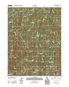
Kimshew Point, California, USGS topographic map dated 2012.
Includes geographic coordinates (latitude and longitude). This topographic map is suitable for hiking, camping, and exploring, or framing it as a wall map.
Printed on-demand using high resolution imagery, on heavy weight and acid free paper, or alternatively on a variety of synthetic materials.
Topos available on paper, Waterproof, Poly, or Tyvek. Usually shipping rolled, unless combined with other folded maps in one order.
- Product Number: USGS-5636517
- Free digital map download (high-resolution, GeoPDF): Kimshew Point, California (file size: 25 MB)
- Map Size: please refer to the dimensions of the GeoPDF map above
- Weight (paper map): ca. 55 grams
- Map Type: POD USGS Topographic Map
- Map Series: US Topo
- Map Verison: Historical
- Cell ID: 23566
- Datum: North American Datum of 1983
- Map Projection: Transverse Mercator
- Map Cell Name: Kimshew Point
- Grid size: 7.5 X 7.5 Minute
- Date on map: 2012
- Map Scale: 1:24000
- Geographical region: California, United States
Neighboring Maps:
All neighboring USGS topo maps are available for sale online at a variety of scales.
Spatial coverage:
Topo map Kimshew Point, California, covers the geographical area associated the following places:
- Oak Point - Granite Ridge - East Fork Last Chance Creek - Keyser Creek - North Valley - Little Rock Creek - Brown Ravine - Jones Meadow - Lynch Meadows - Long Ravine - Millers Meadow - Granite Spring - The Big Hill - Little North Valley Creek - Logue Meadows - Crane Valley - Bald Mountain - Bear Lake - Snow Meadow - Frying Pan Creek - Transfer Ridge - Little Kimshew Creek - Ramsey Bar - Breakneck Canyon - Kimshew Point - Chipmunk Creek - Snow Mine - Table Mountain - Campbell Cow Camp
- Map Area ID: AREA4039.875-121.5-121.375
- Northwest corner Lat/Long code: USGSNW40-121.5
- Northeast corner Lat/Long code: USGSNE40-121.375
- Southwest corner Lat/Long code: USGSSW39.875-121.5
- Southeast corner Lat/Long code: USGSSE39.875-121.375
- Northern map edge Latitude: 40
- Southern map edge Latitude: 39.875
- Western map edge Longitude: -121.5
- Eastern map edge Longitude: -121.375


