
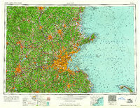
~ Boston MA topo map, 1:250000 scale, 1 X 2 Degree, Historical, 1961, updated 1961
Boston, Massachusetts, USGS topographic map dated 1961.
Includes geographic coordinates (latitude and longitude). This topographic map is suitable for hiking, camping, and exploring, or framing it as a wall map.
Printed on-demand using high resolution imagery, on heavy weight and acid free paper, or alternatively on a variety of synthetic materials.
Topos available on paper, Waterproof, Poly, or Tyvek. Usually shipping rolled, unless combined with other folded maps in one order.
- Product Number: USGS-5636167
- Free digital map download (high-resolution, GeoPDF): Boston, Massachusetts (file size: 22 MB)
- Map Size: please refer to the dimensions of the GeoPDF map above
- Weight (paper map): ca. 55 grams
- Map Type: POD USGS Topographic Map
- Map Series: HTMC
- Map Verison: Historical
- Cell ID: 68685
- Scan ID: 353230
- Imprint Year: 1961
- Woodland Tint: Yes
- Field Check Year: 1956
- Datum: Unstated
- Map Projection: Transverse Mercator
- Map published by United States Geological Survey
- Map published by United States Army Corps of Engineers
- Map published by United States Army
- Map Language: English
- Scanner Resolution: 600 dpi
- Map Cell Name: Boston
- Grid size: 1 X 2 Degree
- Date on map: 1961
- Map Scale: 1:250000
- Geographical region: Massachusetts, United States
Neighboring Maps:
All neighboring USGS topo maps are available for sale online at a variety of scales.
Spatial coverage:
Topo map Boston, Massachusetts, covers the geographical area associated the following places:
- Tappan Corners - West Berlin - Hubbardston Station - Plimptonville - East Sharon - Ashmont - Black Rock - Meadowbrook Mobile Home Park - Elmwood - Goodrichville - West Hingham - The Pines - Wenham - North Grafton - Town Hall Corner - Sharon Heights - South Middleton - Cox Corner - North Andover - Perryville - Bellingham - Fremont Station - Valley View - West Acton - Wellesley Fells - Bank - Camp Bob White - Monponsett - East Groton - Browns Corner - Dudley - East Pembroke - Northwest Duxbury - North Village - Glen Grove Annex - Meeting House Hill - Millbury Junction - West Derry - Cliftondale - Morseville - Hollis Depot - Curzon Mill - Linebrook - South Peabody - Kings Landing - Beachmont - Assinippi - Amesbury - Bennetts Corner - Wollaston - West Peterborough - West Upton - Needham Heights - Greenlodge - Lincoln - Peterborough - New Ipswich - Varnumtown - Braggville - Randolph - Westchester - Blackstone - Clinton - Pages Corner - Springdale - Baker Bridge - Berlin - Seabrook Beach - Wingbrook Estates - Slatersville - North Abington - First Cliff - Plainville - South Boston - Winthrop Highlands - North Uxbridge - North Quincy - Haynes Corner - East Thompson - Wilsonville - North Cambridge - Marblehead Lighthouse - Wilkins Four Corners - Lands End - Munroe Station - Halfway House - Pattenville - Dorchester Heights - Fennerville - Germantown - Cemetery Corners - Groton - East Berlin - Boxford Station - Holbrook - Shirley Center - Windbrook Acres Mobile Home Park - East Arlington - Grants Mills - West Newton
- Map Area ID: AREA4342-72-70
- Northwest corner Lat/Long code: USGSNW43-72
- Northeast corner Lat/Long code: USGSNE43-70
- Southwest corner Lat/Long code: USGSSW42-72
- Southeast corner Lat/Long code: USGSSE42-70
- Northern map edge Latitude: 43
- Southern map edge Latitude: 42
- Western map edge Longitude: -72
- Eastern map edge Longitude: -70


