
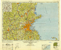
~ Boston MA topo map, 1:250000 scale, 1 X 2 Degree, Historical, 1948
Boston, Massachusetts, USGS topographic map dated 1948.
Includes geographic coordinates (latitude and longitude). This topographic map is suitable for hiking, camping, and exploring, or framing it as a wall map.
Printed on-demand using high resolution imagery, on heavy weight and acid free paper, or alternatively on a variety of synthetic materials.
Topos available on paper, Waterproof, Poly, or Tyvek. Usually shipping rolled, unless combined with other folded maps in one order.
- Product Number: USGS-5636163
- Free digital map download (high-resolution, GeoPDF): Boston, Massachusetts (file size: 24 MB)
- Map Size: please refer to the dimensions of the GeoPDF map above
- Weight (paper map): ca. 55 grams
- Map Type: POD USGS Topographic Map
- Map Series: HTMC
- Map Verison: Historical
- Cell ID: 68685
- Scan ID: 353228
- Woodland Tint: Yes
- Aerial Photo Year: 1944
- Datum: NAD27
- Map Projection: Transverse Mercator
- Map published by United States Army Corps of Engineers
- Map published by United States Army
- Map Language: English
- Scanner Resolution: 600 dpi
- Map Cell Name: Boston
- Grid size: 1 X 2 Degree
- Date on map: 1948
- Map Scale: 1:250000
- Geographical region: Massachusetts, United States
Neighboring Maps:
All neighboring USGS topo maps are available for sale online at a variety of scales.
Spatial coverage:
Topo map Boston, Massachusetts, covers the geographical area associated the following places:
- Pemberton - Phillips Park - West Fitchburg - West Townsend - Turkey Hill Shores - Highlandville - Sheldonville - Fells - Greenville - South Hampton - Ayer - Faneuil - Beechwood - Parkman Corner - Rockport - West Peabody - Norwell - Greendale - Marions Camp - Curtis Corner - West Dudley - Westwood Hills - Potash Corner - Hamilton - Kenwood - East Arlington - Hamilton - North Londonderry - Pine Grove Park - Nason Corners - Acorn Terrace - Lamprey Corners - Braggville - Coolidge Hill - Plumbush - Newton - Noyes Terrace - Sanborn Corners - Upper Green - Brantwood Manor - Five Corners - Graceland Park - Wachusett - Pratts Corner - Stoneville - Greenlodge - Manchaug - Cutter Hill - North Grafton - Lake Forest Park - Prospectville - East Derry - Glen Grove Annex - Proctor - Lexington - South Sutton - Lynnfield - Camp Barton - Newbury Old Town - Linebrook - Kettle Cove Village - North Shirley - Hampstead - Marston Corners - Methuen - Holden - Forest Hills - Parkerville - Bedford - Pilgrim Heights - Milton Hill - Norris Corner - Plaistow - Easton Green - Fort Duvall - Salisbury Beach - Groton - Medford - Topsfield - Rowley - Stonehaven (historical) - Noone - East Weymouth - Suburban Village Trailer Park - Rogersville (historical) - East Berlin - Framingham - Upton - Roxbury Crossing - East Sudbury Station - Ward Hill - Old Common - Cricket Corner - Waites Corner - Haynes Corner - Derry - Hammond Heights - The Five Corners - Braintree Highlands - Hudson Center
- Map Area ID: AREA4342-72-70
- Northwest corner Lat/Long code: USGSNW43-72
- Northeast corner Lat/Long code: USGSNE43-70
- Southwest corner Lat/Long code: USGSSW42-72
- Southeast corner Lat/Long code: USGSSE42-70
- Northern map edge Latitude: 43
- Southern map edge Latitude: 42
- Western map edge Longitude: -72
- Eastern map edge Longitude: -70


